
This one has been on my list for a while as it is a 007 summit, and I came here after my early morning activation of Martin Hill. State Game Land 104 is the way to get to this SOTA peak as other routes are gated or private property. I followed the path suggested by Dave K2CZH, taking Tiger Valley Red from Hyndman to SGL 104, where Tiger Run Rd starts. This gameland is on steep terrain and a scenic road winding up along the northeast side of Savage Mountain.
I drove to the parking area suggested by K2CZH. As this was late December, no gates were closed for hunting season. Checking the PA Game Commission’s Seasonal Roads map, there is a gate at 39.87138,-78.72861 that closes Tiger Run Rd seasonally (open from late September to early February), that would have been about 0.5 miles from the next parking area, where I ended up hiking from (39.87781,-78.72723).


The wind was starting to pick up as I hiked out. After a half mile hiking on a gravel road, I had to go off this path to follow a quasi-trail. A lot like the hikes away from the roads in other game lands, this is somewhere between a cleared trail and open bushwhack.


The wind had really started to come in as I set up close to the summit. The trees were swaying a little and a light dusting of snow also came down. It was a dramatic activation, but a successful one with 43 QSOs, including a 17m S2S with KC3TVC on W3/SV-005 Wills Mountain less than 5 miles away and who I had just met on Martin Hill earlier this morning.


Wills Mtn, Martin Hill, and Savage Mtn are SV-005, -006, and -007 respectively, and make up a good trio of summits south of Bedford. The deep ridge/mountain topology makes it take longer to get from peak to peak, but they’re all worth doing. Savage Mountain was the last of the trio I have activated.
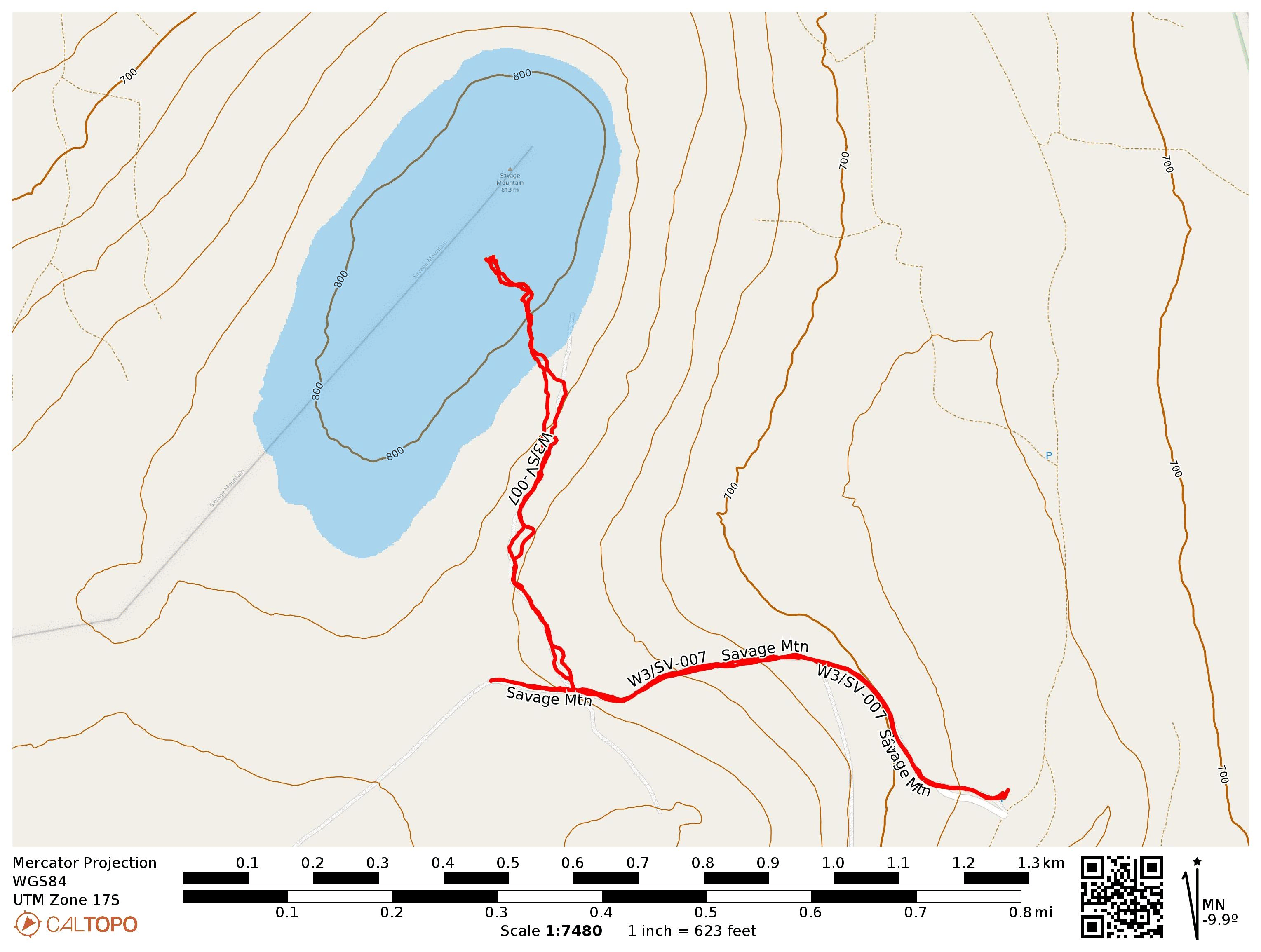
- Trailhead: 39.87776, -78.72723 : SGL 104 Parking Area
- Maps: [AA3TZ SOTA]
- Route: 2.0 mi RT hike with 500′ EG.
- POTA: US-8803 PA 104 State Game Land