
After my evening in Bedford, I returned to this spot in Buchanan State Forest where I failed to activate last winter. I had run out of time after taking a long W3/SV-005 Wills Mtn and operated at a spot called “Martin Hill” on my map that was about a half mile from the AZ. It was time for redemption!
After driving through Sweet Root Natural Area and seeing its alluring vistas, I parked at the end of Tower Road by the radio tower. The gate leading to Evitts Mountain Road was open, so I could have kept driving all the way into the activation zone along the well-maintained gravel road, which is characterized as a “Drivable Trail” on the forest map. I opted to hike in instead, following the same path I did last time.


I passed by the Mid-State Trail which briefly follows this gravel road before diverting away shortly after the start of this hike. The last time I was here was my first encounter with this trail. Now I’ve hiked several sections of it on several SOTA outings, and know how rough/rocky it can get! This might be the smoothest section of the MST that I’ve been on so far. This section also happens to be the high point of the MST.
It was a windy day, and I could hear the trees creaking under the strain of the persistent gusts. Some light hail briefly appeared too. I pulled over at a parking area inside the AZ and set up my antenna, maybe a half mile before the actual summit. As I was getting started, Dan KC3TVC was driving by in his truck, on his way to activate as well! He said he normally does the hike, but the road is just so good, so he drove this time. We chatted a bit more, and then he drove along to the other side of the AZ for his activation.


I only operated on 40m for this activation. I kept it to 20 minutes on that band to work the locals, then move on to the next hikes of the day. The wind had died down a bit, and some blue was visible in the sky on the hike back. It would not last too long, as a winter storm was forecast to come in this afternoon.
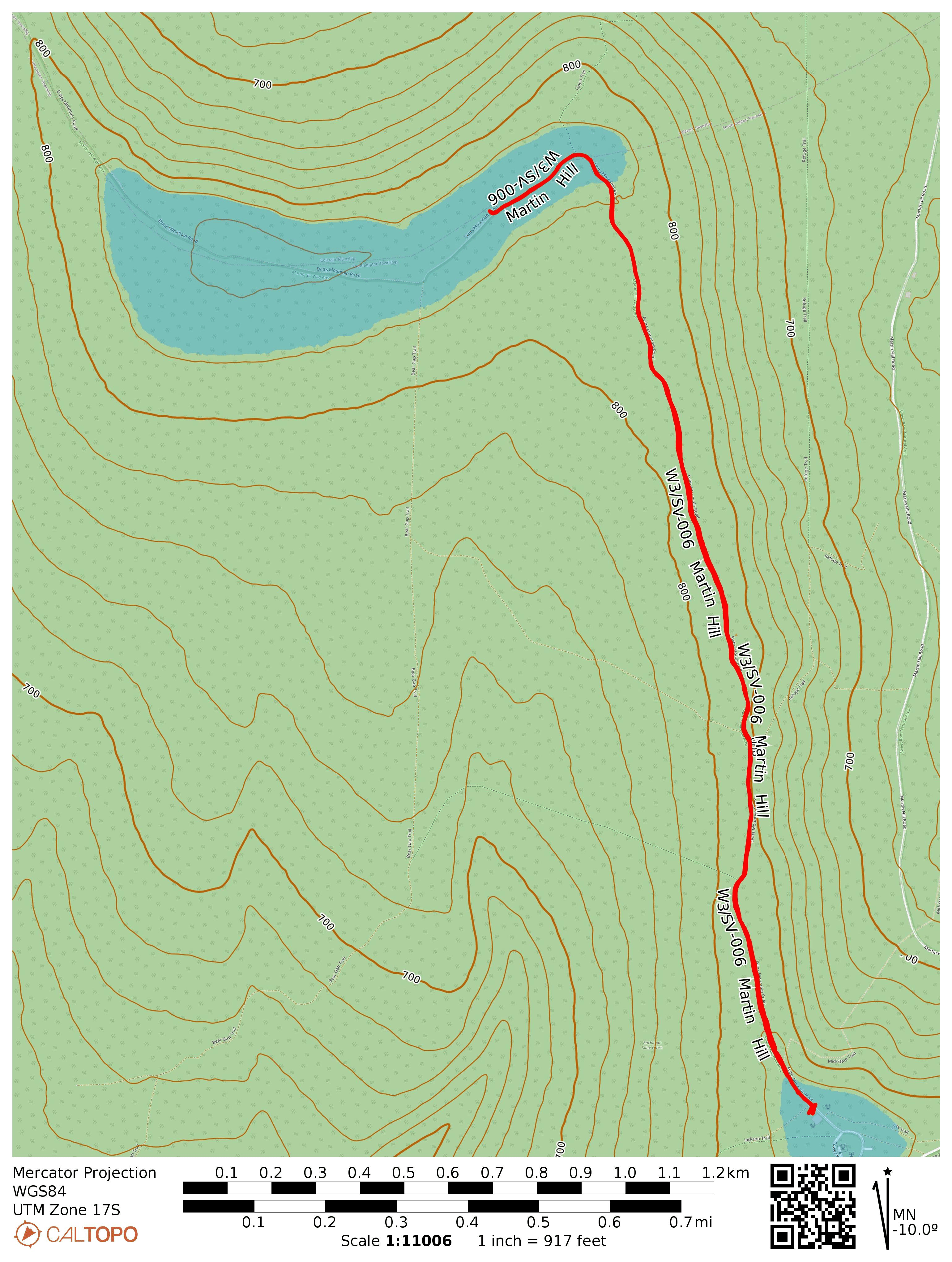
- Trailhead: At the end of Tower Road, by the radio tower, where Evitts Mountain Road begins: 39.79122, -78.43923. If the gate is open, you can just drive up to one of a few parking areas in the activation zone. I operated at 39.84894, -78.55262.
- Map: [AA3TZ SOTA] [Martin Hill Wild Area Map]
- Route: 3.2 mi RT hike along Evitts Mountain Road.
- POTA: US-5463 Buchanan State Forest. Close to US-0626 Sweet Root State Conservation Area, but this is not within the AZ.
One thought on “W3/SV-006 Martin Hill”