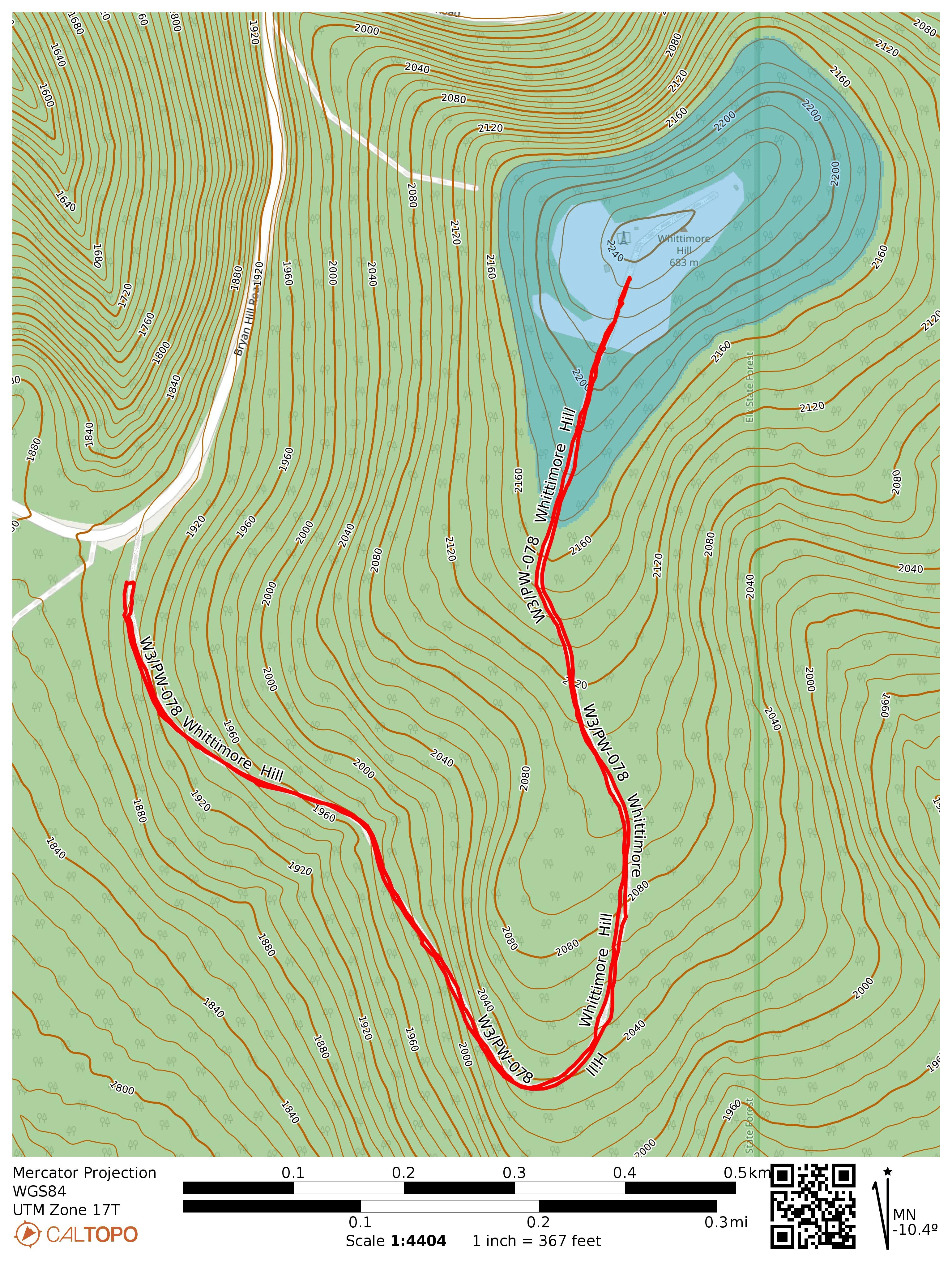
This tract of Elk State Forest is not far from the hike I did a few days earlier at W3/PW-076 2655, and I stopped by on my way back to Pittsburgh. It was the start of an oppressive heat wave that would be accompanied by wildfire smoke from the north, and the temperature was already above 90 F here. I parked at the gate for Whittimore Tower Road and followed the trail.
It was a well shaded climb with a large number of fungi of different shapes growing throughout.
Closer to the radio transmitter site and bright red-painted firewatch tower, the trail opens up into a field with tall grass. This looked like it would have been a fun tower to climb, but like most of these towers in the state, it was gated off.
Trailhead: 41.47832, -78.26548 : Gate of Whittimore Tower Road
I was on the way to the PA Wilds to check out the night sky during the new moon, and stopped to try this never-before activated, unnamed peak in State Game Lands 014. This one has been on my list for a while. It appears that one could approach either from the north, bushwhacking the entire way from a parking area in SGL 014, or from the south, starting the hike along a dirt logging road in Elk State Forest. Both hikes climb ~800 feet in elevation, but the latter spreads that out over two miles instead of one. I opted to spread out the climb to make it a bit easier.
It’s all gravel and dirt roads leading to the gate. Don’t bring your horse (even though there is a Thunder Mountain equestrian trail, this isn’t part of it)!
I started the hike in the mid-afternoon, parking beside the gate of Thunder Mountain Road, after driving north on West Hick Run Road for some time. This road appears to provide logging access to this part of the forest. The road weaves up the mountain and gains roughly 400 feet. After about a mile on the path, I came across a drainage that I had intended to bushwhack along to the summit, but the logging road continued higher so I followed that. This was a mistake, since the eventual bushwhack to the summit included some dense mountain laurel brush. It would be better to go off trail earlier, following the much shorter fern vegetation that grows along the drainage. Along the way, I saw some elk droppings in various places.
Around here is where one should plan to go off trail, even though the road continues further into some large clearings. There is a lot of mountain laurel growing up ahead.It is called Elk State Forest, after all.
Eventually, I made it to the more open area leading up to the activation zone. As soon as I stopped, a bee that had been following me for a while stung me right on the top of my head, ow! Tree cover was everywhere, but I found a place to set up near the actual summit. This time, I brought with me a new 40m K6ARK EFHW for its inaugural activation (after my last wire antenna snapped) along with the MTR3Bv4. I really enjoy this little radio, especially after the version 2.4 firmware upgrade which makes the user experience very smooth. Earlier versions were very easy to accidentally activate CW enunciation of the frequency, which I did far too often.
A bit of a clearing near the hilltop. The Currahee coming out to debut its new firmware!
The most notable QSO this time was YT2AAA in Serbia on 20m. I also managed to score the first two S2S QSOs from this summit, from two true SOTA regulars: K6EL on W6/NC-298 Vollmer Peak, and Darryl WW7D on W7O/CN-106.
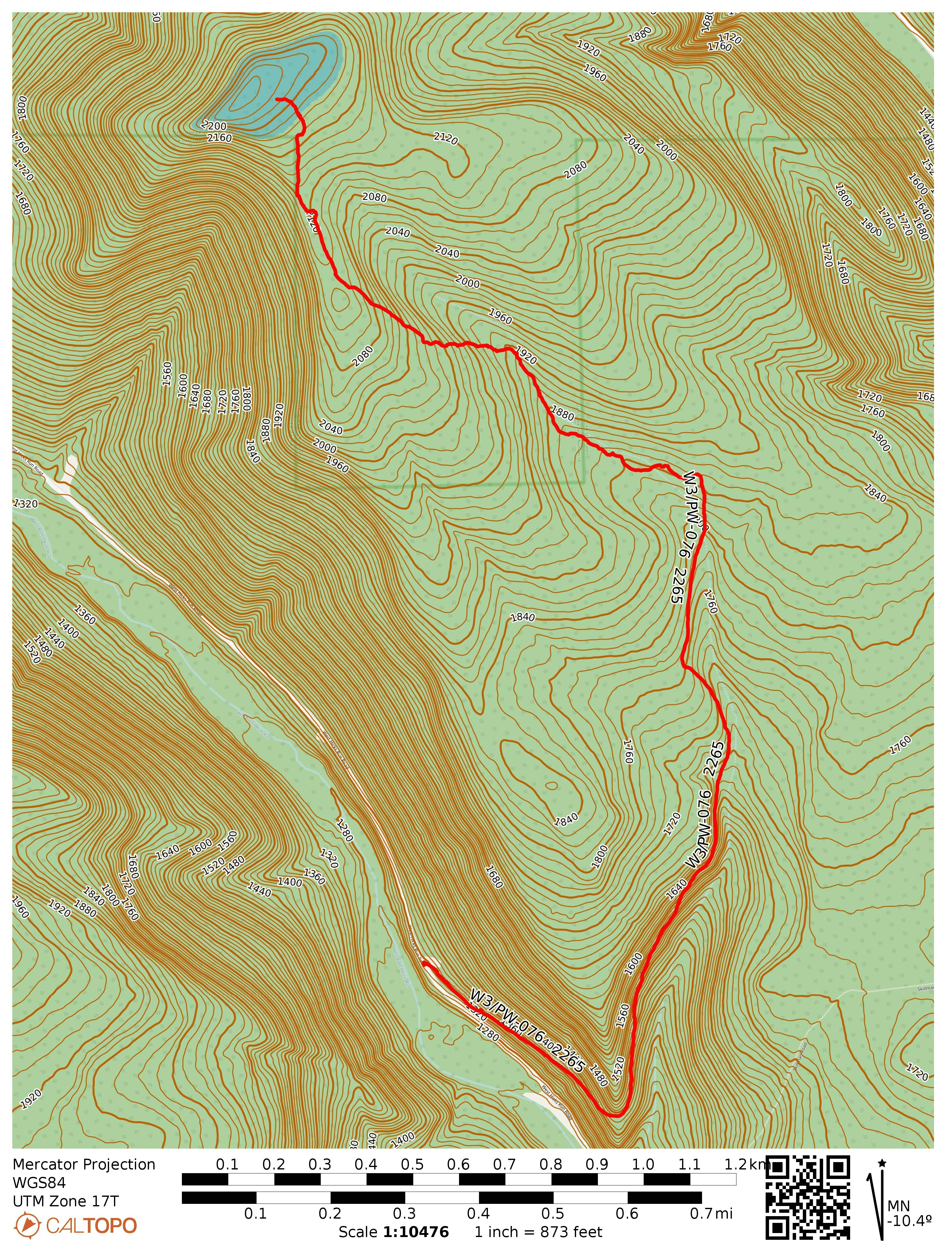
By the time I got 21 in the log, it was 5 pm, and the elk were starting their evening activity. A 5-7 point buck sprinted across the hilltop, about 100 yards away from me, evidently spooked about something. I took this as a sign that I should pack up and get back to the trail as quickly as I could. On my return, I chose my line through the brush carefully, following the more western ridge south to get to the drainage, and I completely avoided any dense growth the entire way back. I highly recommend following my suggested route on this map for the bushwhack, along with some common sense!
The boundary with the state game lands has some cleared trail that I found on the way back, along the more western ridge, going south.
On returning to the road portion of the hike, I heard a couple unusual animal calls that sounded like otherworldly screams, which I later learned is the “elk bugle.” It’s an almost ethereal, fantasy creature sort of sound, and it makes me want to come back in the fall for the elk-watching during mating season. On the way out, I saw an elk doe bounding across the valley, tail up and alert. Elk are quite large!
Suggested route, based on my GPS track on the return hike. Avoid taking the logging road further north of the drainage, as that will lead you to some dense mountain laurel brush!
Trailhead: 41.41221, -78.33270 : Gate of Thunder Mountain Road
Route: 4.6 mi RT hike, 900 feet elevation. First mile follows Thunder Mountain Road, the rest is a bushwhack.
POTA: US-8724, PA 014 State Game Land
At my campsite in Cherry Springs, I did a short POTA activation before the sunset, then hung out in the observation field to see the night sky. There was not a single cloud, was a perfect night for stargazing! The Milky Way really stood out as a highlight, and the number of satellites whizzing by was not something I had really appreciated before seeing them all over the place like this!
Stargazers assembling on the former airstrip, waiting for nighttime.