
This past Saturday, May 28, I went to Sunol Regional Wilderness to activate Maguire Peak, which at 1688 feet, is often overlooked in favor of taller summits nearby (Mission Peak, Mount Diablo). My friend James was visiting from Ohio, and he was interested in a hike with fewer people, and this one definitely delivered! Despite the beautiful day, we only saw three other hikers the entire time. This was the very first SOTA activation of this mountain, and also my first attempt at an HF activation (though it did not start out that way!).
We parked on Welsh Creek Road after getting a parking permit from the ranger at the Sunol Wilderness main entrance, and started onto the trail. The first part of the hike was a climb through a wooded area that leads to the exposed, sunny trail that loops around the Maguire Peaks and is evidently popular with cows.
There are two popular use-trails on the west face of the mountain for access to the summit. To ascend, we used the southwest ridge use-trail, which is the grassier and slightly less steep of the two. Since these use-trails are narrow and near tall grass, we had a lot of pointy plant bits sneak into our shoes by the time we got to the summit. The peak is breezy and there’s a boulder perfect for sitting down on, and some shade offered by a small cluster of trees.


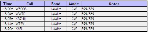
After resting at the summit for a few minutes, I took out my equipment and realized that I forgot to bring a microphone compatible with the FT-817! Luckily, I had a speaker-mic for my HT (which I had not brought) in my antenna bag and I found that I could key CW with it by squeezing the PTT switch! I used an end fed wire antenna with one end tied to a tree and got to town on 20m with my squeeze-key once I found an open frequency on the novice band (there was a contest this weekend).
I was fortunate to have strong signals coming in from skilled chasers, including the prolific K6EL, who has now worked me on 3 of my 7 activations.
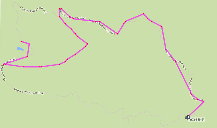
I also experimented with APRSDroid to report our GPS location to APRS over the cell network. We gained coverage as we climbed up onto the loop trail and up the mountain, so you can see the use-trail paths more clearly. Next time I’ll try reporting by packet to keep RF use 100% amateur radio. 🙂


 Tom Zajdel