On the way back from my yearly trip to Ohio for Xenia Hamvention and Cincinnati to visit my folks, I detoured through Chillicothe to try some new-to-me SOTA peaks documented by Chris N8PEM: W8O/SE-012 1225 and W8O/SE-016 1190B. Both of these nameless peaks sit in Tar Hollow State Forest northeast of Chillicothe. I did not see any logging activity/traffic on my trip, but this was the last week of turkey hunting season in OH, which led to an interesting encounter!

W8O/SE-012 1225
As suggested in N8PEM’s and KC8JPZ’s reports, I approached this site along Bunn Road. Once it enters the state forest, the road is unpaved, just like in PA. The gravel road had weeds growing in the crown, and should probably be tackled with a high clearance vehicle. I turned onto Park Road 12 to the trailhead, which has plenty of space to park off the road.


The path is an overgrown ATV trail that is fairly easy to follow, despite the growth. It crosses a creek/ditch, and then gradually climbs up into the activation zone. There are a few downed trees that have to be crossed near the beginning of the trail, and closer to the top, thorny briars cross the path. The trail got so overgrown that I thought the only way up would be to bushwhack (reader: the trail is there. Stick with it!) All in all, this is much better and faster than pure bushwhacking! About a half mile into the hike, the path ends in a large clearing and it’s an easy spot to get a wire up.


I noodled around a bit on 40m, enjoying a relaxed pace, getting 27 in the log in the end. I did try 15m to round things outd, but I don’t think band conditions were too great, with a K index of 5. I managed to work F4WBN and DL9NCI on 15m for DX.
I didn’t bring my permethrin-treated clothes on this trip, so I had to flick off a couple ticks when I made it back to the car. I’m starting to know what a tick crawling across my leg/hand feels like! Their little legs are sharp, and they start charging fast when they realize you found them!!
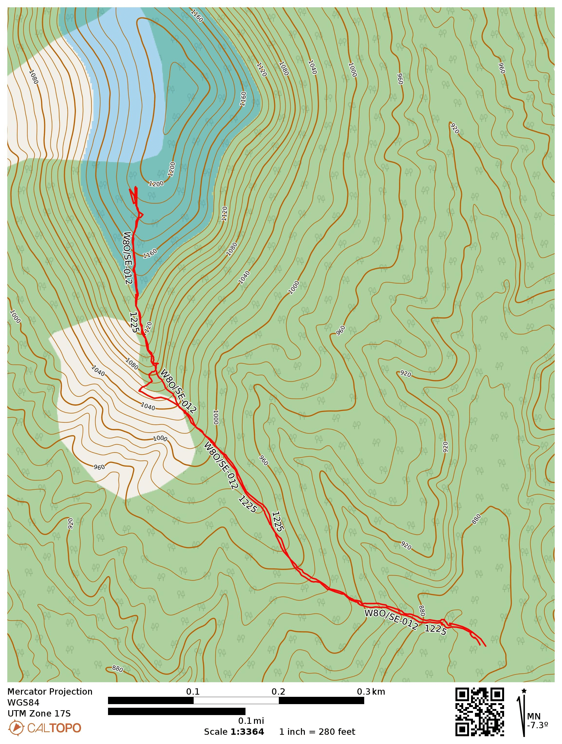
- Trailhead: 39.39943, -82.81673 : Pullover in front of ATV trail by Park Road 12, in the Ruffed Grouse Management Area
- Maps: [AA3TZ SOTA] [Tar Hollow State Forest Map]
- Route: 1.0 mi out-and-back along ATV trail
- POTA: Tar Hollow State Forest (US-5452)
W8O/SE-016 1190B
This one is a drive-on, with the high point on South Ridge Road. I drove on to park on a side gravel road. This would have been a convenient place to set up, but another car was parked there. Instead, I took a short walk down the road to the Bridle Trail until I found a log to sit on. The trail was marked with green blazes.
As I had finished setting up, a father and his two teenage children walked by, all decked out in ghillie suits. The kids, a brother and sister, were each holding a camouflaged shotgun, confirming that they were looking for turkey before the season ends on Sunday. They passed by me and the log, continuing north on the trail, no doubt going to where the turkeys were. Despite growing up in Ohio, this was the first time I had seen hunters in the state. Tells you something about where I usually hung out!


Since it was 11 am local, I started on 20m, working Gary W0MNA and Martha W0ERI, the SOTA duo that I had just met at Dayton! This was now the 53rd time I had worked both of them on an activation. That’s over a third of all my summits! I worked the same DX as on the last summit, F4WBN and DL9CNI, just this time on 20m. They sounded stronger on 15m, but still good copy. After some time on 40m for the locals, including KF9D who is one of the 11 activators who has done this peak before, I packed it up with 23 in the log.
I didn’t hear any firearm discharge the whole time, so perhaps no turkeys were harmed today.
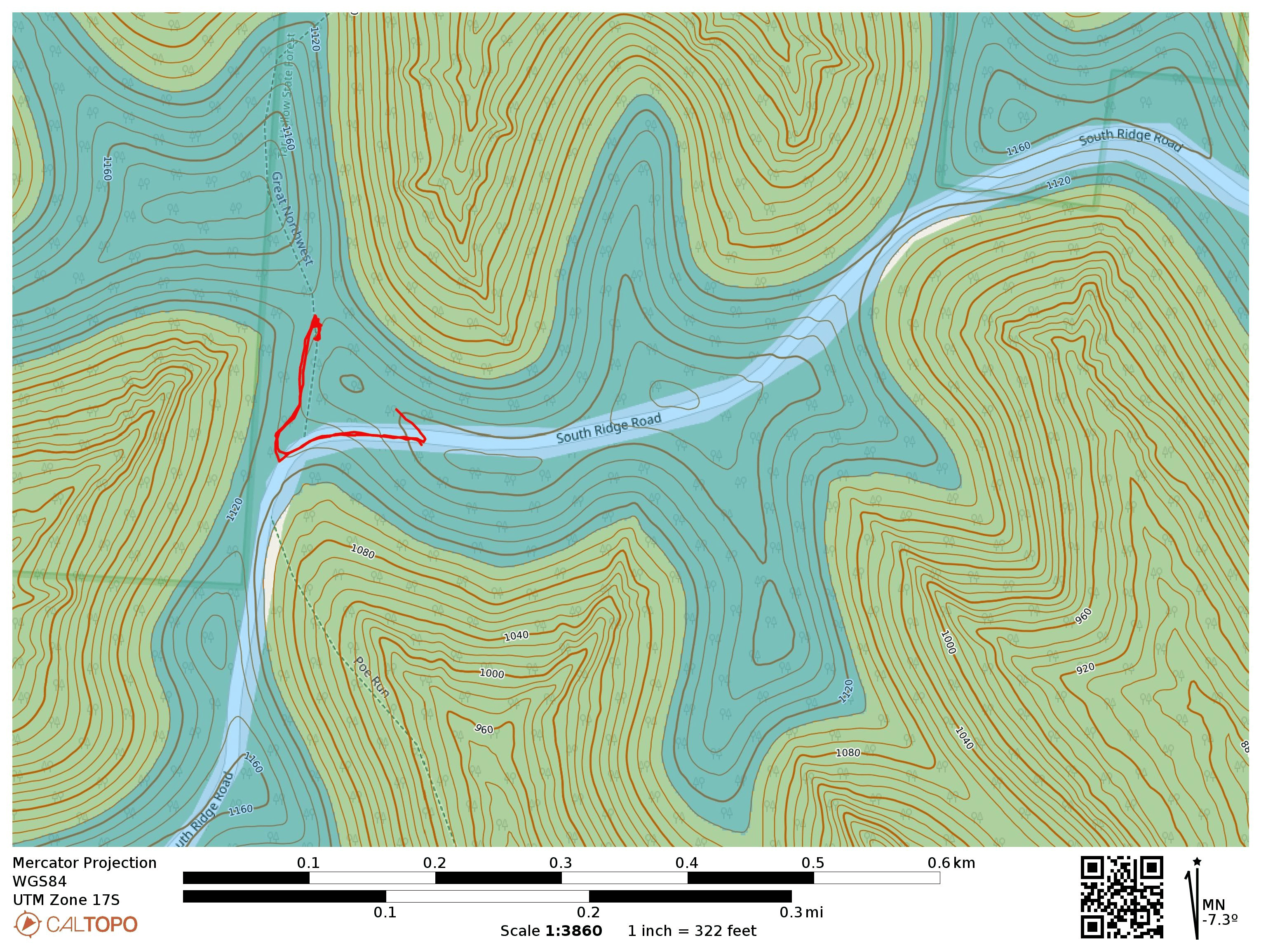
- Trailhead: 39.34548, -82.79135 : Gravel road that meets South Ridge Road
- Maps: [AA3TZ SOTA] [Tar Hollow State Forest Map]
- Route: Drive-on. I walked just about 0.1 mi into Bridle Trail (green blazes) to find a log to sit on in the AZ. The zone is large, so there are many potential operating locations.
- POTA: Tar Hollow State Forest (US-5452)