This was my second and last summit on the way back from the W8V SOTA campout. Barton Knob is an easy activation to add on, as it’s just a few miles west on US-250 from Gaudineer Knob. I drove along the gravel Barton Knob Tower Road, which has a parking area by an overlook, and there the road is gated. A short hike along the gravel road winds up to the firetower, which cannot be easily climbed (the first few ladder runs have been removed).
I worked Mike AD8IS immediately on 40m. I could hear N8JEP on 2m FM, who had been waiting around on his summit to work me again, but he couldn’t hear me and packed up. I did manage one S2S, with KG0AT on W0C/FR-005 on 20m. Not the most scenic views on this foggy day, but I reckon it would be nice at a clearer time. I packed it in quickly to get back on the road.
Trailhead: 38.61691, -79.93245 : Parking area along Barton Knob Tower Road
On my way home from the first-ever W8V SOTA campout in Watoga State Park, I stopped by Gaudineer Knob in Monongahela National Forest. This place has a lot of hype, and for good reason. Evidently another CCC picnic area, this is perhaps the most scenic picnic area I’ve ever seen! The parking lot itself is within the AZ, but I hiked the short loop through the picnic area.
This morning was foggy and misty, and the moss-carpeted spruce forest was surreally beautiful. I sat at one of the picnic benches and settled in for a nice activation. A hiker from Colorado who was touring WV and western PA stopped by to chat for a bit, and we both gushed about our surroundings. This is definitely one you’ve got to check out if you’re in the area!
I managed to work N8JEP S2S on W8V/PH-068 Thorny Creek Mountain with 2m FM at the tail end of this activation, and he was on his way home from the campout as well.
Trailhead: 38.61560, -79.84381 : Gaudineer Picnic Area
Route: Parking lot is in the AZ, though the 0.3 mi Gaudineer Knob loop hike is worth your time.
POTA: US-0632 Monongohela National Forest
KI6CR has created a wonderful “Activator Toolkit” plugin for WordPress that I’m going to try using in some of my blog posts, rendering both a contact map and GPS map. Check it out!
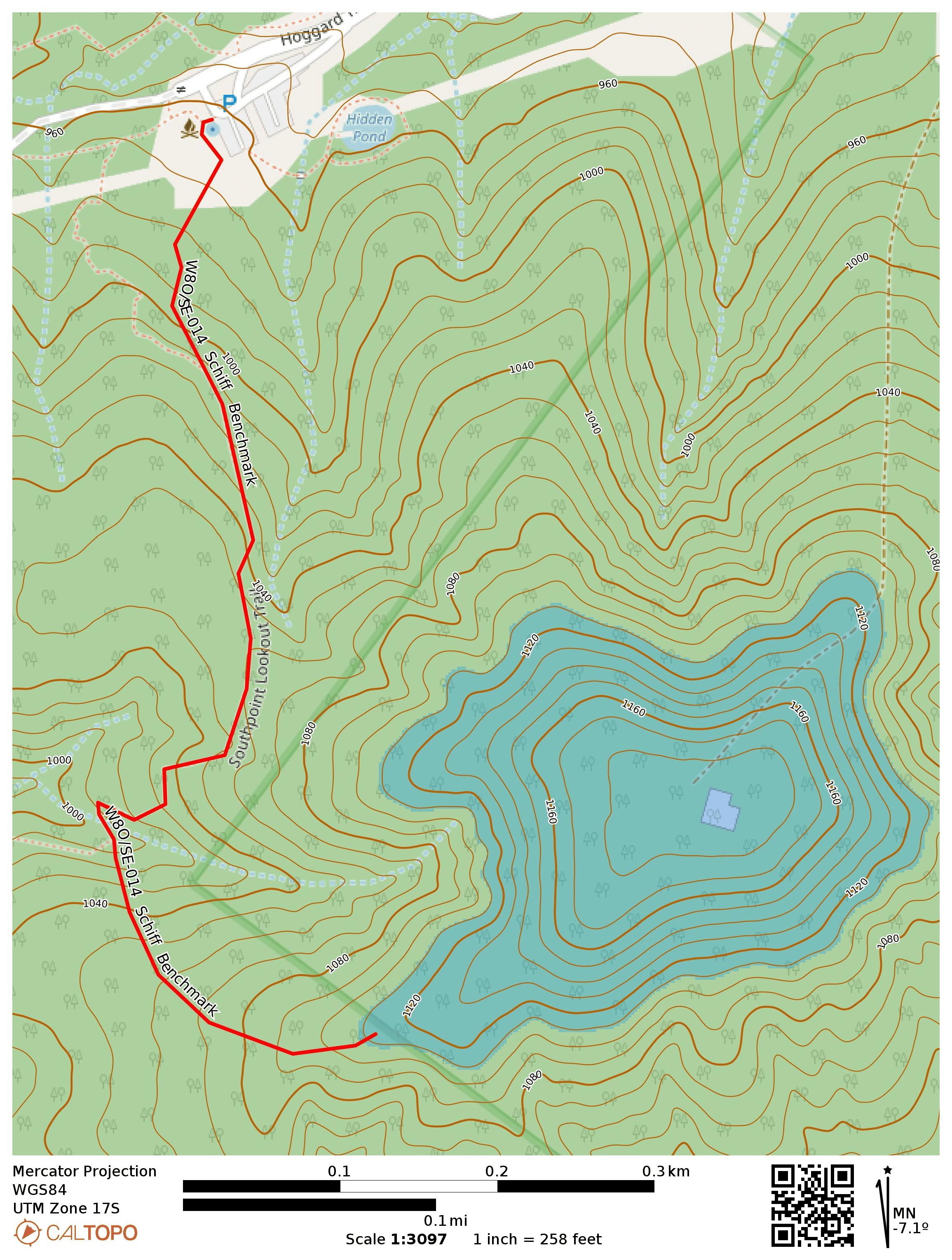
Now on the return from my trip to Indianapolis/Cincinnati, I drove back through Chillicothe to do another new-to-me OH SOTA hike. I had just worked Mike AD8IS on Schiff Benchmark after we completed our first activation of Staley Knob just a week prior. I couldn’t resist stopping by on the way back to make it a SOTA complete.
The hike is in Buzzard’s Roost Nature Preserve, a Ross County park. I followed the Lookout Trail until it passed a creek.
I left the Lookout trail to follow an ATV path, as documented by OH SOTA expert Chris N8PEM. I followed this right up to the edge of the nature preserve to stay off of private property where the actual summit is.
I had a successful activation, and notched three more S2S contacts: N1SMB on W0C/SR-051 (15m), KT0A on W0D/BB-079 (20m), and N4MAP on W4G/HC-005 (20m). Another complete in the log, this one brought my total to 55!
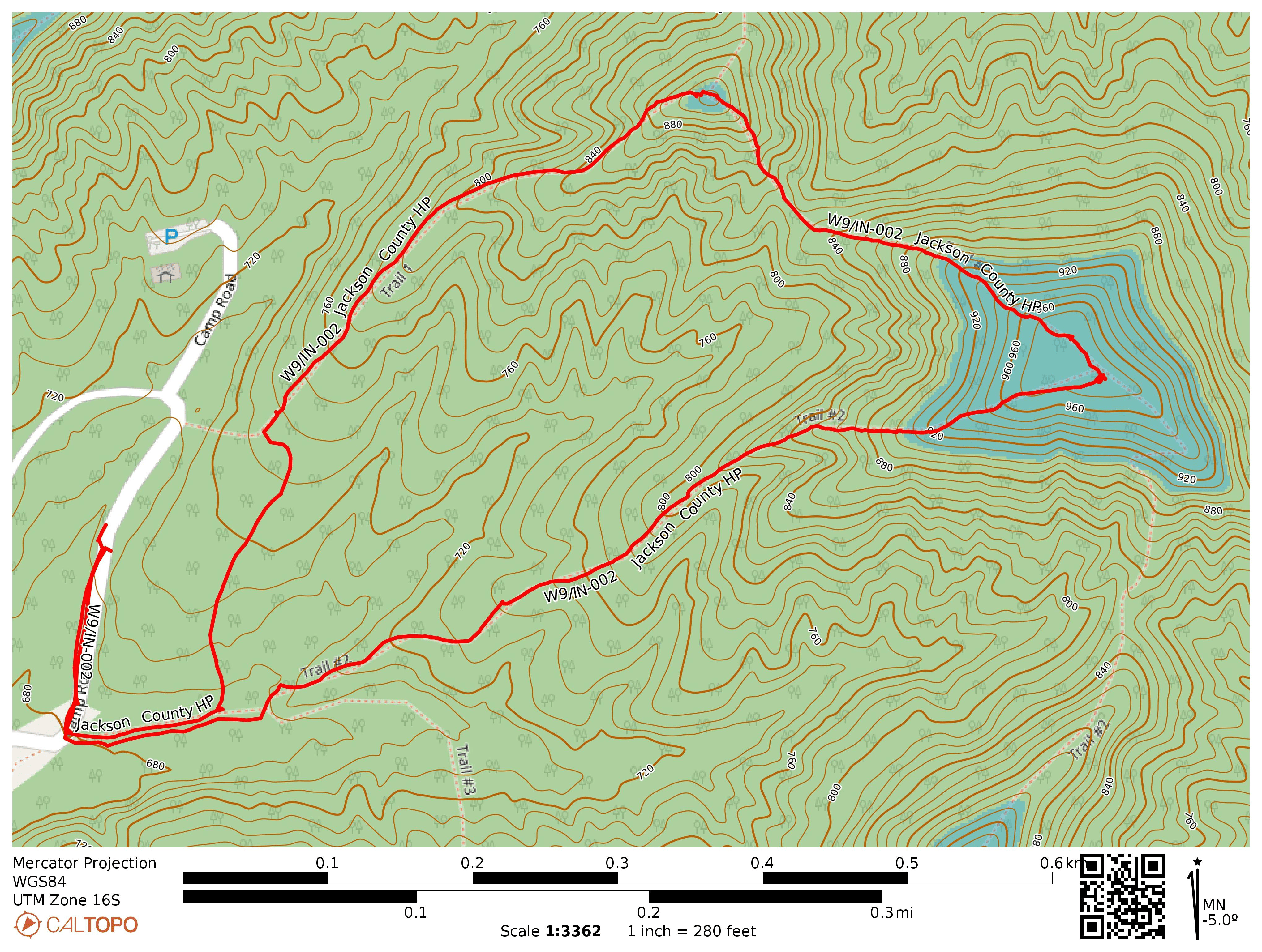
The state of Indiana, roughly the same size and aspect ratio as the Republic of Korea (as some of my students have pointed out to me), contains just 3 SOTA summits. Two are on public property that is easily accessed. On a drive to Indianapolis for a workshop, I stopped at Jackson-Washington State Forest for the shorter hike of the two, Jackson County High Point. This one requires no off-trail hiking, so it was ideal to squeeze in a SOTA activation before I had to be in Indianapolis in the mid-afternoon.
I parked off of Camp Road and hiked along Trail #1 to a CCC Shelter area built during the Depression. It looks like the Civilian Conservation Corps was very busy throughout the eastern states, as their work is all over PA, OH, and IN state parks. A short walk through the area brought me to a climb up to an old watchtower site. Only the foundation remains. While this spot would be a great place to operate radio, it’s not inside the AZ, so I continued along Trail #2 to the High Point, which is labeled on the state forest map with an elevation of 985 feet ASL.
I operated by the side of the trail for an hour, working a good 44 QSOs, though no S2S. I enjoyed the time, but found two ticks on my backpack when I was finished, arms outstretched in “questing” mode, ready to suck some blood.
Somebody wants a hug!
Afterwards, I drove on to Bloomington, IN to meet Bryce KD9YEY for lunch and a BKG 2m QSO in the parking lot. I have gotten to know him as part of the Sofas on the Air Discord community. He’s a relatively new CW op but has improved rapidly due to his experience with snare drumming! We chatted for a while, and talked a bit about his journeys backpacking, hiking, and activating POTA in the Hoosier State and elsewhere, and he posts entertaining videos documenting these outings on youtube.
Trailhead: 38.86637, -86.00003 : Parking for CCC Shelter, near Knob Lake
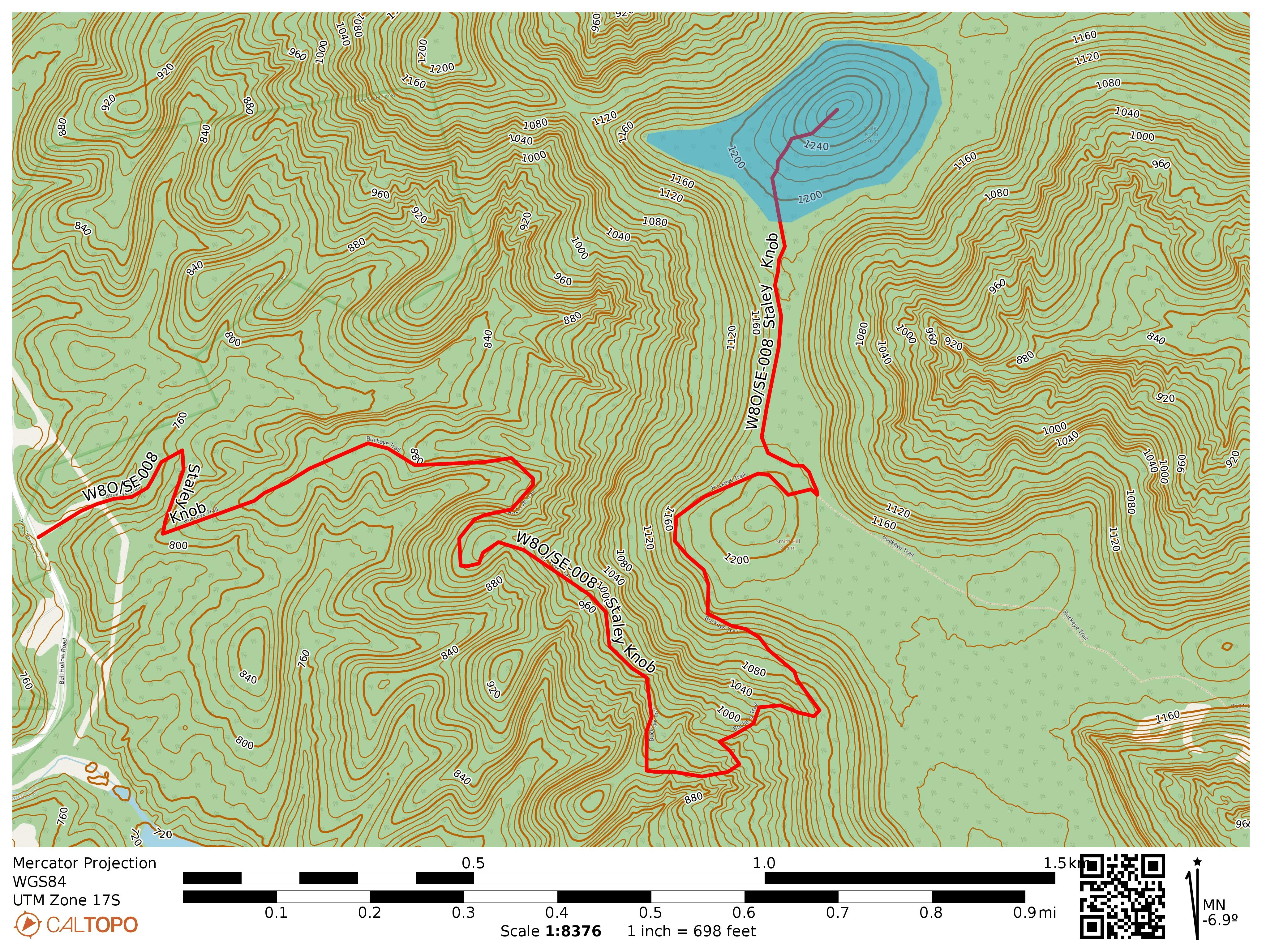
At Xenia Hamvention this year, I met Mike AD8IS at the SOTA gathering. We were talking about the idiosyncrasies of SOTA activations in Ohio, which is a very flat state, and traded notes we had on Staley Knob, a not-yet-activated summit south of Chillicothe very close to a segment of the statewide Buckeye Trail. We were both eyeing the first activation and agreed to join forces for it, planning to regroup in August.
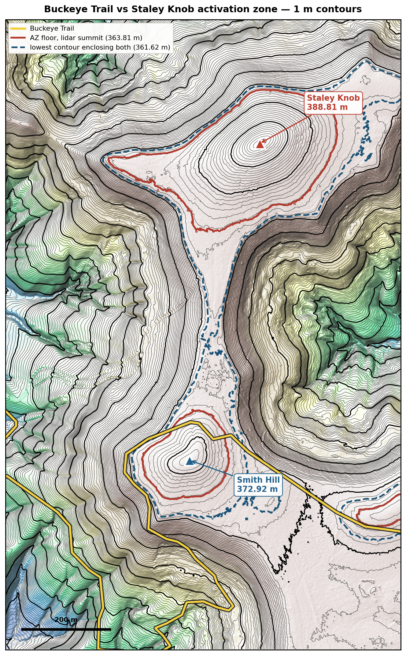
This portion of Buckeye Trail, part of the Sinking Springs section, passes along an easement through Cave Lake Camp, a privately owned campground that is part of the OH-WV Youth Leadership Association. Staley Knob is about half a mile north of the BT, connected by a saddle ridge to Smith Hill which the trail climbs along. Mike and I tried to determine if the AZ might reach along this saddle to include the BT, which led me to pore over LiDAR point clouds and DEM maps in a way I had never done before.
I learned a lot about LiDAR and was surprised to learn that the state of OH is very well-surveyed, being the first state to be completely mapped in 2007, following a state-sponsored survey, the OSIP. An updated USGS survey was completed between 2019-2023 as part of the federal 3DEP (3D Elevation Program). According to the latest and highest resolution 1-meter survey, it appeared that the very peak of Staley Knob is about 1275 feet, not the 1270 feet listed in the SOTA database (perhaps due to rounding to the nearest contour line from some earlier survey, but I’m not sure). The key col between Smith Hill and Staley Knob was tantalizingly close to staying within a 25m contour, but we were talking about maybe 2 meters of margin. Is LiDAR that accurate? I am starting to believe it might be, with some caveats!
Here is the GeoTiff from the 3DEP data, with the Buckeye Trail gpx track from CalTopo overlaid (yellow), rendered with 1m contour lines. I am by no means an expert in this area, so I worked with the DEM GeoTiff, not the raw point clouds, and used the Claude GenAI tool to add rendering and annotations that would help illustrate the topographical situation. A GIS professional could make a better visualization with proper tools, but this is just for fun because something very important happened to make all this analysis moot!
Mike covered a bunch of sources of error that might creep into LiDAR data, particularly over vegetated land like the forest surrounding Staley Knob. The 1 meter DEM are processed from raw LiDAR point clouds that record the time of last arrival over roughly 1 meter horizontal areas. If there is heavy brush on the ground preventing any light from striking the floor, some inaccuracies may be recorded. If such brush were present on the peak and resulted in a 2 meter overestimation of the summit, then there is some uncertainty that might push the activation zone further down towards Smith Hill. The USGS 3DEP specification for the OH survey that included this area cited a quality level of up to 30 cm VVA (vegetated vertical accuracy) at the 95th percentile. That means there are some areas, 5% of independent preselected quality checkpoints,have an absolute error greater than 30 cm. So in vegetated terrain, errors are not normally distributed. That makes sense, because vegetation on the ground can only add error to the estimated ground elevation, and this will skew towards outliers over areas with large amounts of plant matter/detritus covering the ground.
Here is a rendering AD8IS made of the raw LiDAR point cloud of the summit area. You can see there are trees and ground debris that affect the measurements.And looking from the profile, you can see some some spread in the vertical direction around the ground plane. I am unsure of the scale in this image, but this illustrates some of the measurement “noise” inherent in LiDAR point clouds.
All this is to say that I was getting a little nervous about the probability that the BT was in the Staley Knob AZ. I felt that maybe any error or overestimation at the peak might also be added to the col, raising both together and not changing the AZ boundaries much. The only way I could see this (as a skeptical non-expert) working out is if the survey managed to both overestimate the summit (outside the 95th percentile) while also getting an accurate measure of the key col. Plausible, but I wanted something a bit more firm.
We were doing this analysis because Mike had trouble getting in contact with Cave Lake Park with the number posted on their Facebook page. As a last ditch effort, I rang the OH-WV YLA headquarters and got in contact with somebody who gave me another cell number for Sonny, the manager. This actually worked, and I was able to secure permission from Sonny just a couple days before our planned activation date. Our analysis was an interesting exercise, but now thankfully moot as far as this activation was concerned.
Sonny’s actually a licensed ham, though not currently an active one, and is fine with SOTA activators going to Staley Knob, provided that 1) it is not a hunting season and 2) he is notified ahead of time. There are a large number of hunting stands around the Cave Lake property, so avoiding the off-trail area during hunting season is a safety issue. You can reach out to me for Sonny’s number. He told us to park in front of a red gate where the BT transitions from a road walk to the Cave Lake property, proceeding east on the BT for a shorter approach. There doesn’t appear to be an official parking spot this close to Staley Knob.
Mike AD8IS and I met up in Pike Lake State Park (POTA US-1983) the evening before and did a night time activation of the park while going over plans. We passed his FX-4CR back and forth, which would be how we would end up operating on the knob the next day. There was forecasted rain that was to hit around noon, so we wanted to get going early in the morning if possible.
We parked in front of the red gate on the side of Bell Hollow Road (39.10312, -83.34455). The gate is closed but not locked, and the blue blazes for the BT mark that this is where the trail continues on from the road. We were able to just fit my subcompact SUV and Mike’s pickup in front of the gate, but it was tight. Worth mentioning some photo credits: any photos that look like they were not taken with a mixture of petroleum jelly and sweat on the camera lens, those would be Mike AD8IS’s pictures! The rest are mine.
The trail was a bit overgrown along this first part, as expected for this time of year. Sonny did warn me that it would be pretty rough going. We passed a couple of massive anthills.
Before long, we were in the forest. The BT was more clear and wound through the trees, and the hike became more enjoyable. At some point, we came across some small animal’s (deer calf?) bones on the trail.
At just about the 2 mile mark, we made it to Smith Hill and were ready to walk across to Staley Knob. Don’t turn too quickly like we did at first. There is a really nice ATV clearing (or “deer highway”) that crosses the BT that takes you directly to the knob, avoiding the worst bushwhacking. Staley Knob rises from the other side, and is semi-open. There is definitely stuff on the ground that LiDAR may have had trouble with, but we were able to get right to the peak which felt good.
We started the activation with a 2m CW QSO to get AD8IS into the ranks of BKG, and also to get points for the 2026 SOTA 2m Challenge. I went back to the saddle and then slipped down the steep hillside to make sure I was out of the AZ, and we used my Quanshengs to make the contact. Then, we traded places so I could get by 2m contact from the peak, and I set up my 40m EFHW while I waited for Mike to get back afterwards.
At this point, the sky was getting dark, so we needed to get on with the HF activation. Colorado had a 14er summit event going on, so we tried to chase some S2S, trading the FX-4CR back and forth. Mike got one of the CO stations on 20m SSB, but the QSB was pretty rough this morning. A young (stray?) dog, looked like some kind of shepherd mix, ran through the woods nearby which was concerning to me, but it didn’t really appear to even acknowledge us. We were able to get a few S2S on 40m with folks in VA, but then thunder came quick and it started to downpour, cutting our HF operating time to just about 30 minutes. We packed up as quickly as possible, and the rain was relentless. I hope the dog found some shelter.
Rain selfie. Excited for the successful FA, not so excited for the health of my well-moistened LiFePO4 battery. Alas, I need to bring a drybag with me on future potentially rainy activations.
The rain cleared up completely by the time we finished the return hike, of course. At this point we were well drenched, but thankfully safe in spite of the storm. We stopped by Bainbridge to get lunch and celebrate the successful first activation! There is a dental museum there, which claims to be the first dental school in the US and promises to transport you “to the root of American dentistry.” Maybe worth a stop next time I’m in the area. W8O/SW-002 Reeds Hill looks like an interesting hike not far from here, and there are a number of other good spots near the Buckeye Trail. Mike went and activated W8O/SE-014 Schiff Benchmark after lunch, and the timing worked out that I could chase him from my parents’ place in Cincinnati!
Scratch another SOTA peak off the OH list!
Trailhead: 39.10312, -83.34455 : Red gate off of Bell Hollow Road
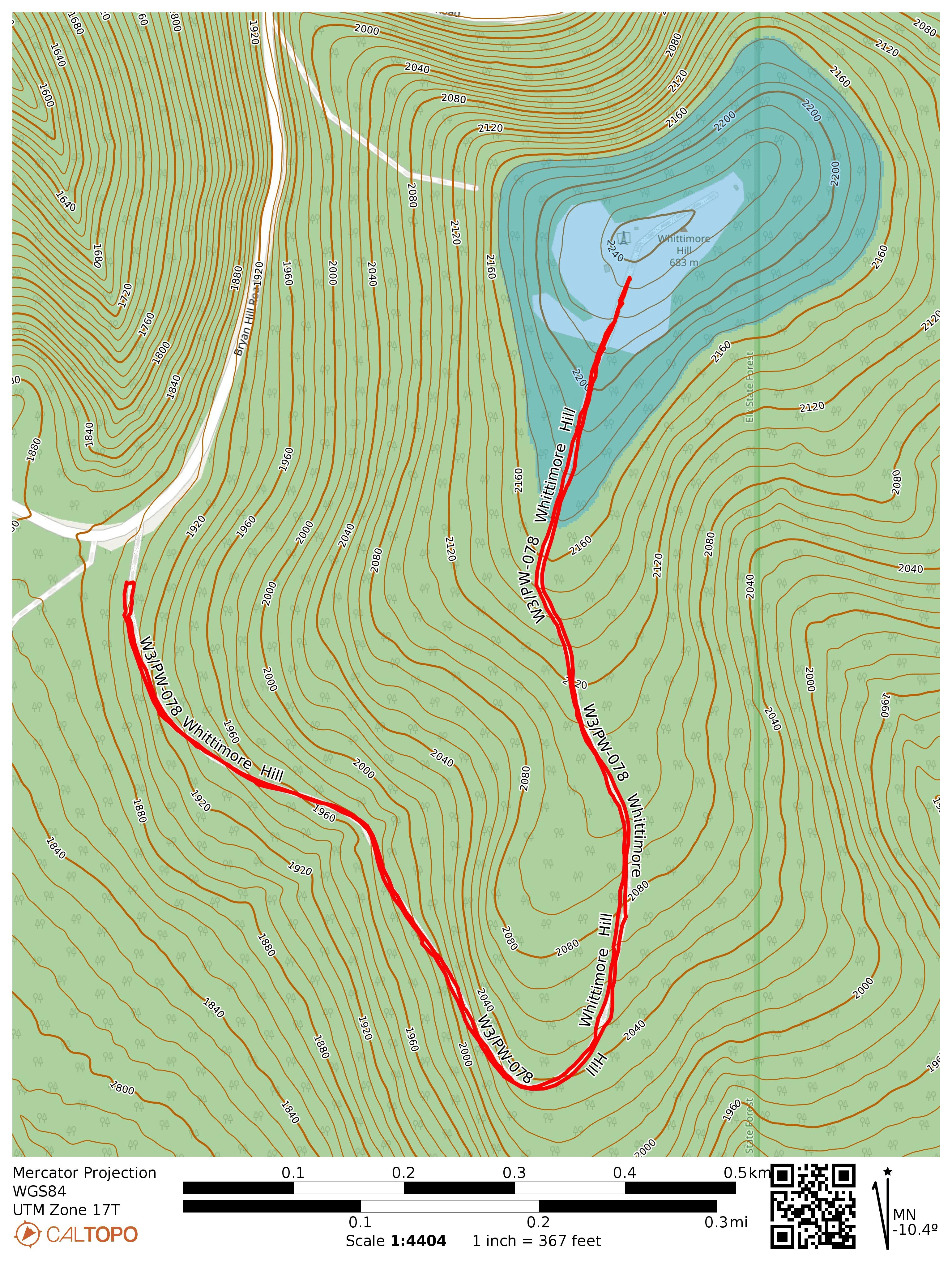
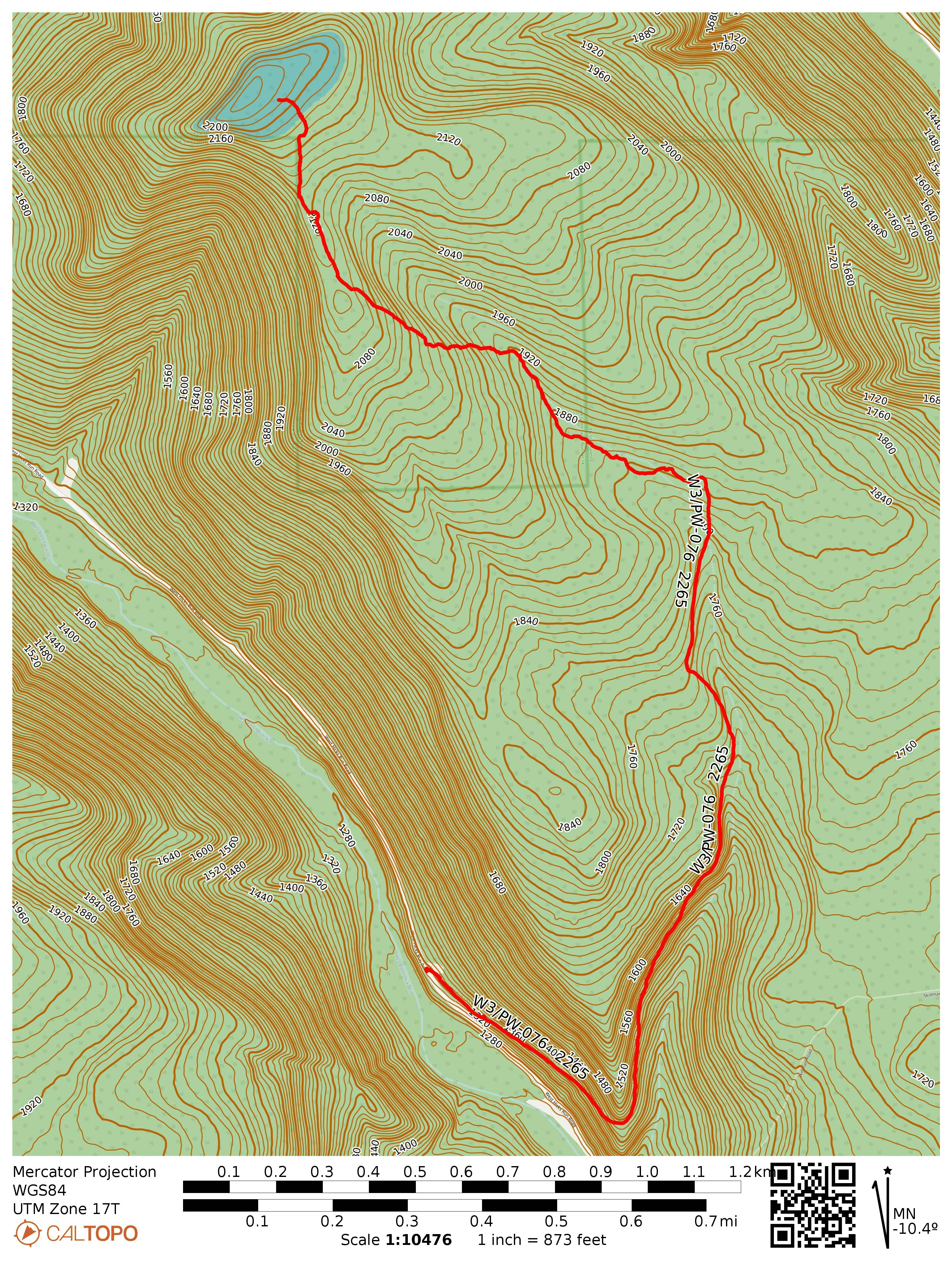
This tract of Elk State Forest is not far from the hike I did a few days earlier at W3/PW-076 2655, and I stopped by on my way back to Pittsburgh. It was the start of an oppressive heat wave that would be accompanied by wildfire smoke from the north, and the temperature was already above 90 F here. I parked at the gate for Whittimore Tower Road and followed the trail.
It was a well shaded climb with a large number of fungi of different shapes growing throughout.
Closer to the radio transmitter site and bright red-painted firewatch tower, the trail opens up into a field with tall grass. This looked like it would have been a fun tower to climb, but like most of these towers in the state, it was gated off.
Trailhead: 41.47832, -78.26548 : Gate of Whittimore Tower Road
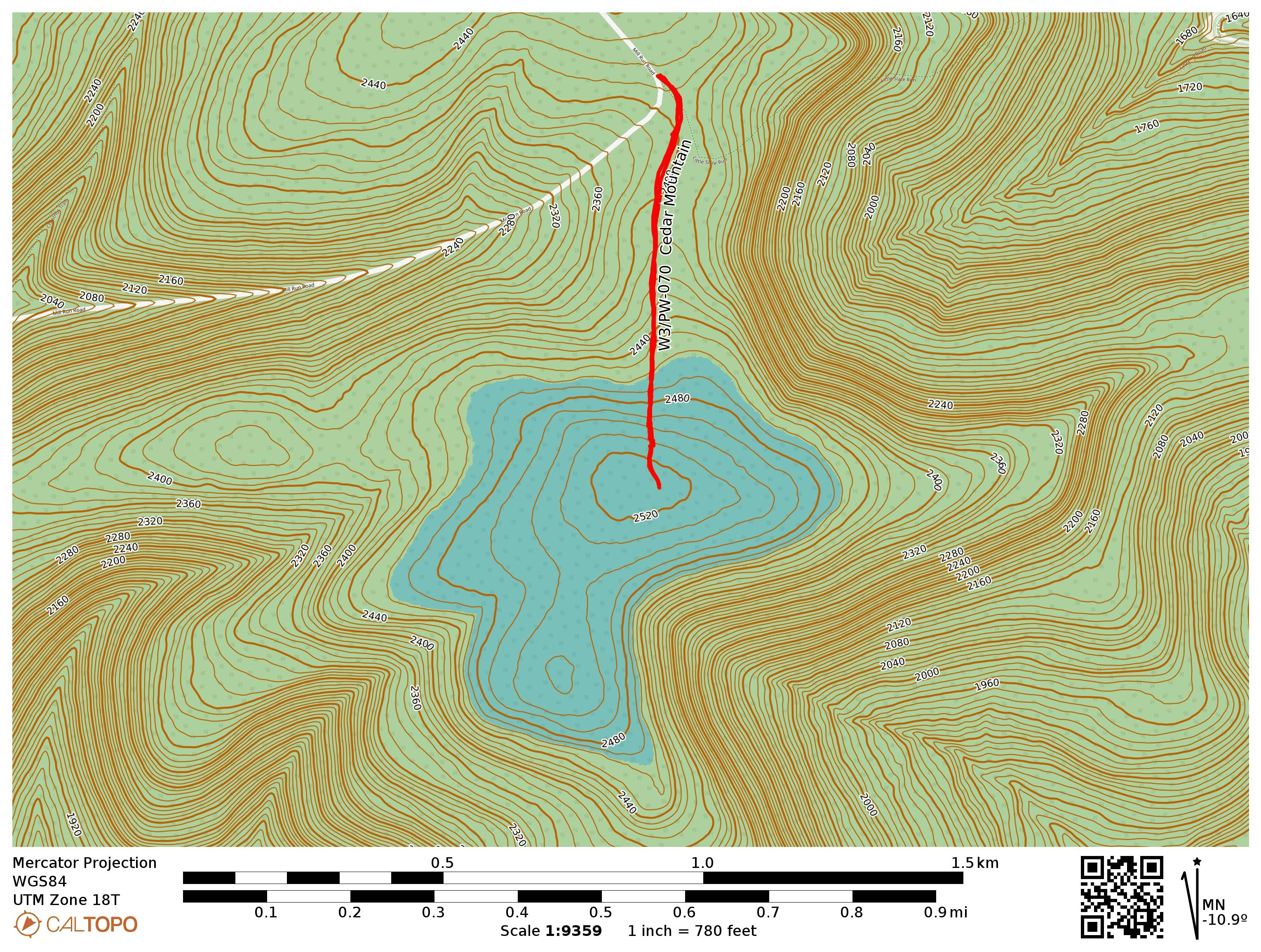
After tackling Mt Tom in the morning, I headed over to this second, 1-mile round trip activation, also in Tioga State Forest. I parked at the side of Mill Run Road, by a gated access road that runs due south to a radio transmitter site. Now that it was mid-afternoon, I noticed that I was not doing great on 40m, so most of this activation was on 20m. I worked an S2S with KT0A on W0D/BB-006 and W7UM on W0C/FR-019, both on 20m.
Trailhead: 41.66459, -77.50264 : Gated access road off of Mill Run Rd
Route: 1.0 mi RT hike, ~200 feet elevation along access road
POTA: US-5478, Tioga State Forest
After this one, I went on a POTA rove, activating several of the PA Wilds state parks: Lyman Run SP, Denton Hill SP, and Patterson SP. I just went for 10-12 QSOs at each, picking up quickly to move on to the next one. I think Patterson is a great alternative to Cherry Springs for dark skies access, and the campsite seems much less crowded.
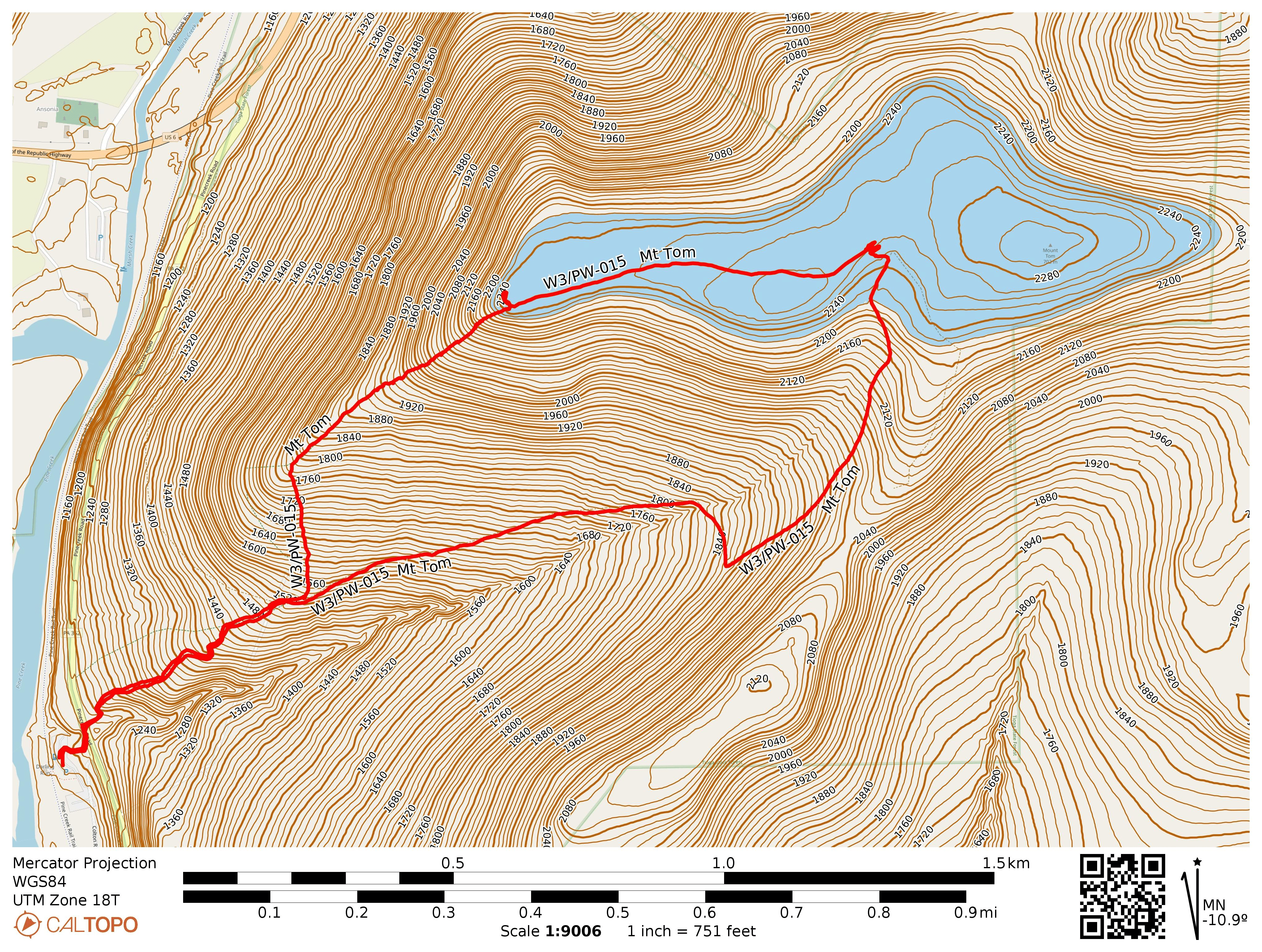
I parked at the Darling Run access of the Pine Creek Rail Trail, and there was a signpost for the hike towards the northeast end of the parking lot. There are also some toilets at the parking lot, just in case! A few steps into the trail, I crossed PA-362 and started on the bulk of the hike. Yellow blazes mark the trail well, and it seems relatively highly used. Not too overgrown like many lesser-traveled footpaths at this time of year.
About 0.4 mi into the hike is a choice to go the steep and shorter way or the not-so-steep but longer way. I decided to take the steep path up and that resulted in a climb of 750 feet over those 0.6 miles, over a 20% grade on average. That was…pretty tough. I saw some mushrooms and a road on the way. Evidently the mushrooms I caught bioluminescent in darkness.
At the top is a vista point that is just on the edge of the AZ. The hike becomes a pleasant walk east along the ridge, though here the grass had gotten tall. I hiked towards the summit and operated near the terminus of the return trail.
The hike down was less relentlessly steep, but it still would be quite the climb. It follows an old road that isn’t really blazed, so the trail is wider but it’s a bit less scenic.
Trailhead: 41.73633, -77.42913 : Pine Creek Rail Trail – Darling Run Access
I was on the way to the PA Wilds to check out the night sky during the new moon, and stopped to try this never-before activated, unnamed peak in State Game Lands 014. This one has been on my list for a while. It appears that one could approach either from the north, bushwhacking the entire way from a parking area in SGL 014, or from the south, starting the hike along a dirt logging road in Elk State Forest. Both hikes climb ~800 feet in elevation, but the latter spreads that out over two miles instead of one. I opted to spread out the climb to make it a bit easier.
It’s all gravel and dirt roads leading to the gate. Don’t bring your horse (even though there is a Thunder Mountain equestrian trail, this isn’t part of it)!
I started the hike in the mid-afternoon, parking beside the gate of Thunder Mountain Road, after driving north on West Hick Run Road for some time. This road appears to provide logging access to this part of the forest. The road weaves up the mountain and gains roughly 400 feet. After about a mile on the path, I came across a drainage that I had intended to bushwhack along to the summit, but the logging road continued higher so I followed that. This was a mistake, since the eventual bushwhack to the summit included some dense mountain laurel brush. It would be better to go off trail earlier, following the much shorter fern vegetation that grows along the drainage. Along the way, I saw some elk droppings in various places.
Around here is where one should plan to go off trail, even though the road continues further into some large clearings. There is a lot of mountain laurel growing up ahead.It is called Elk State Forest, after all.
Eventually, I made it to the more open area leading up to the activation zone. As soon as I stopped, a bee that had been following me for a while stung me right on the top of my head, ow! Tree cover was everywhere, but I found a place to set up near the actual summit. This time, I brought with me a new 40m K6ARK EFHW for its inaugural activation (after my last wire antenna snapped) along with the MTR3Bv4. I really enjoy this little radio, especially after the version 2.4 firmware upgrade which makes the user experience very smooth. Earlier versions were very easy to accidentally activate CW enunciation of the frequency, which I did far too often.
A bit of a clearing near the hilltop. The Currahee coming out to debut its new firmware!
The most notable QSO this time was YT2AAA in Serbia on 20m. I also managed to score the first two S2S QSOs from this summit, from two true SOTA regulars: K6EL on W6/NC-298 Vollmer Peak, and Darryl WW7D on W7O/CN-106.
By the time I got 21 in the log, it was 5 pm, and the elk were starting their evening activity. A 5-7 point buck sprinted across the hilltop, about 100 yards away from me, evidently spooked about something. I took this as a sign that I should pack up and get back to the trail as quickly as I could. On my return, I chose my line through the brush carefully, following the more western ridge south to get to the drainage, and I completely avoided any dense growth the entire way back. I highly recommend following my suggested route on this map for the bushwhack, along with some common sense!
The boundary with the state game lands has some cleared trail that I found on the way back, along the more western ridge, going south.
On returning to the road portion of the hike, I heard a couple unusual animal calls that sounded like otherworldly screams, which I later learned is the “elk bugle.” It’s an almost ethereal, fantasy creature sort of sound, and it makes me want to come back in the fall for the elk-watching during mating season. On the way out, I saw an elk doe bounding across the valley, tail up and alert. Elk are quite large!
Suggested route, based on my GPS track on the return hike. Avoid taking the logging road further north of the drainage, as that will lead you to some dense mountain laurel brush!
Trailhead: 41.41221, -78.33270 : Gate of Thunder Mountain Road
Route: 4.6 mi RT hike, 900 feet elevation. First mile follows Thunder Mountain Road, the rest is a bushwhack.
POTA: US-8724, PA 014 State Game Land
At my campsite in Cherry Springs, I did a short POTA activation before the sunset, then hung out in the observation field to see the night sky. There was not a single cloud, was a perfect night for stargazing! The Milky Way really stood out as a highlight, and the number of satellites whizzing by was not something I had really appreciated before seeing them all over the place like this!
Stargazers assembling on the former airstrip, waiting for nighttime.
I haven’t been participating in the SOTA 2m weak signal mode challenge so far this year, since I seldom even get any 2m FM contacts in western PA. On the way back from Charlotte, we stopped for a couple days in Shenandoah National Park and some of my experiences there got me thinking that I should be putting a bit more of an effort into VHF ops. I brought a NR7Y-modded K1 Quansheng, a 3-element arrow Yagi-Uda, and my classic FT-60R with a long-ranger half wave whip. I had good results taking on some of the peaks off of Skyline Drive in SNP and engaging with the VHF SOTA chasing community out there.
Roy WN3F recommended a list of W4V Skyline Drive summits that he did in one day in early March: Hawksbill (SH-001), Stony Man (SH-002), The Pinnacle (SH-005), Hogback Mountain (SH-007), and North Marshall (SH-009). I have chased three of these, so this trip put some more completes in my SOTA annals.
June 25: Hawksbill and Stony Man
On the first afternoon, I opted for Hawksbill and Stony Man, since these are two of the more popular hikes in SNP. Just a mile of hiking along the Hawksbill trail and I was at the summit area. Many people were climbing around the rocks, so I tried to find a place a bit away from the observation deck to keep my end fed wire out of the way. The view was terrific, but my operating spot may not have been ideal for VHF, since I had forest blocking my way to the east where the most active chasers are.
I pointed my 2m beam east and with horizontal orientation, thankful for the memory keyer feature on the NR7Y firmware. Moments later, I got both KK4UZK and W4GO calling me. Matt W4GO runs an RBN from his home QTH under his wife’s call KK4HHP which picked me up immediately and made it very easy to rustle up 2m contacts throughout this trip. Jordan KK4UZK later shared that he worked me on a 5-element tape measure Yagi. I also got W4VIG and K4ET on 2m FM. I then wrapped the activation on HF and worked a couple S2S on 20m: WB7BWZ on W7M/FN-184 and K6EL on W6/NC-423.
Reunited with Luna, I hurried on towards Stony Man. Stefanie hung out at the Skyland lodge and kept the FT60 to be one of my QSOs. I was running out of time because partway into the hike I found out that the Stony Man trail is one of the few in SNP that prohibits pets! After taking Luna back to the trailhead, I hustled up to the summit with 40 minutes left in the UTC day to do a 2m-only activation. The pressure was on! The sun was setting against the rocks and the light was perfect, and many hikers made it out to watch the remains of the day’s light. After taking in this sight, I doubled back to a trail junction with a horse hitching post and went down a side trail with nobody on it.
On 2m FM, I called Stefanie first, then worked a number of chasers, including N4QD and KE8YWV who were actually working Chris KI6CR on Mount Davis in PA! I couldn’t hear Chris, but it was cool to overhear the other side of these QSOs. I wrapped up with W4GO on 2m CW, and thus finished my first 2m-only SOTA activation in years with 7 QSOs in the log and 20 minutes to spare. I jogged down the half-mile return trail, past some deer coming out to graze so Stefanie, Luna, and I could make our way back to our room for the evening.
June 26: The Pinnacle and Hogback Mountain
I took Luna out for an early morning drive to get to the trailhead for The Pinnacle, a hike along the Appalachian Trail just off Skyline Drive. I parked at the Jewell Hollow Overlook and we set off along a grassy spur trail until linking up with the AT.
Our path to the AT for the hike to The Pinnacle.
After following the AT for just over a half mile, we reached a group of rocks within the AT. Here, I called on 2m FM for a while, gathering a number of contacts before switching to 2m CW. Unfortunately, I left my key at the room, so the CW had to be sent with the side keys of the K1. It was tricky to do this well while holding the Yagi, but I was able to work W4VIG and W4GO with CW.
To round off the day, Luna and I parked at the trailhead parking for Overall Run, then hiked east along the AT to Skyline Drive, which we crossed to follow Hogback Tower Road into the activation zone. Here, I spent some time doing HF, using the PTT button of my mic to key the KX2! Here is where I worked Roy WN3F for the first and only time on this trip, having used his helpful hints the entire way. I also got W4VIG and W4GO in the log on 2m CW, and Matt W4GO managed to chase me on all four peaks! As a final bonus, Hogsback was my 7th 007 reference, wrapping up the Moore SOTA activator badge.
Across these four activations, I logged seven 2m CW QSOs, which put me on the board for the 2026 SOTA challenge. Also notable is that our QSO on Hawksbill induced KK4UZK into the Brass Knuckle Gang, an eclectic group of 2m CW enthusiasts. I too am a BKG Member, #49, and enjoyed getting my first “wild” 2m CW QSOs on these SOTA activations!
Since these peaks are all well-documented by the W4V SOTA community, I won’t rehash any additional details on parking/trails/etc. There are many easy hikes in the park to check out! Stony Man seems to be the most popular, and for good reason! I highly recommend checking that one out if you’ve only got time for one.