
After wrapping our previous long hike and activation in Jacks Narrows, Luna and I headed into Tuscarora State Forest to do a few more new summits. I parked on Licking Creek Drive, where there is the option to hike either west to Blue Mountain W3/SV-030 or east to Blacklog Mtn W3/SV-028, two parallel ridges that the forest road runs between. We opted for the latter.
We followed the red-blazed Birch Run Trail, and shortly into the hike was a bridgeless creek crossing, about 10 feet across. The water level was just over a foot deep on this early spring day, so that’s something to be aware of when going for this hike.

Past the creek was a gentle climb to a small clearing and another trail sign, and here the trail gets much steeper and rockier, with a classic PA boulder field at some point. We continued up to the ridge and then left the trail for a final short, open bushwhack up along the ridge into the activation zone.


There are plenty of trees around and got my contacts. By this point, Luna understood the routine and sat calmly, letting me work for about 40 minutes to get 36 QSOs. On the way back, Luna had a big dog moment, sniffing out our own track and excitedly guiding us right back to the trail. Our path back followed exactly our route there, according to the GPS, so she did a great job!

At the end of this hike, I decided to check out the semi-famous “Campsite 009,” the site of W3/SV-024 Shade Mountain. I’ll have to come back here for Blue Mountain some time.
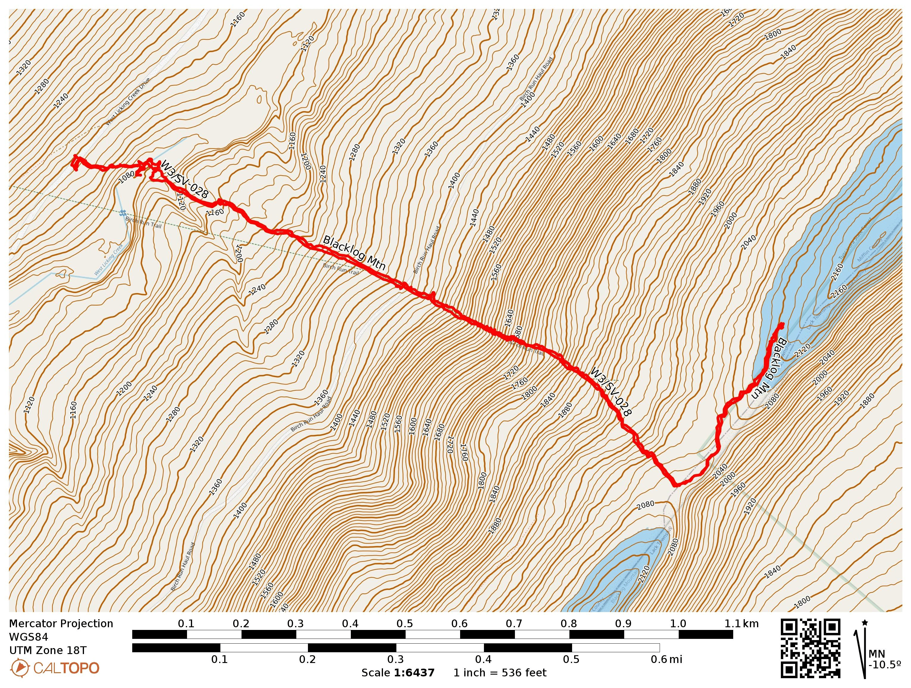
- Trailhead: 40.39025, -77.75942 : by Licking Creek Road
- Map: [AA3TZ SOTA] [Tuscarora State Forest]
- Route: 2.5 mile RT hike along Birch Run Trail, with a short ridgeline bushwhack; ~1000 feet of total elevation
- POTA: US-5479, Tuscarora State Forest