
I drove here early in the morning on my way to Milwaukee to get a SOTA complete. Rather than drive to Sauk Point itself for a roadside activation, I hiked into the activation zone in Devil’s Lake State Park. I parked at the end of Solum Lane and followed a 0.25-mi spur of the Ice Age Trail until I reached the Sauk Point Trail. This intersection is within the activation zone, though CalTopo’s maps (both OpenStreetMap and MapBuilderTopo) incorrectly chart the trail as going northeast when the actual path is nearly due north from the parking area. The trail may have been rerouted at some point.


I strung my 40m EFHW up along the Sauk Point Trail, called CQ on 40m, and got 34 contacts in just a half hour on 40m alone, and had to pack up to move on to the next activation. I am really liking this inverted vee configuration for the end fed wire antenna, and I believe that it is excelling! The MTR3Bv4 is such a delight, too!
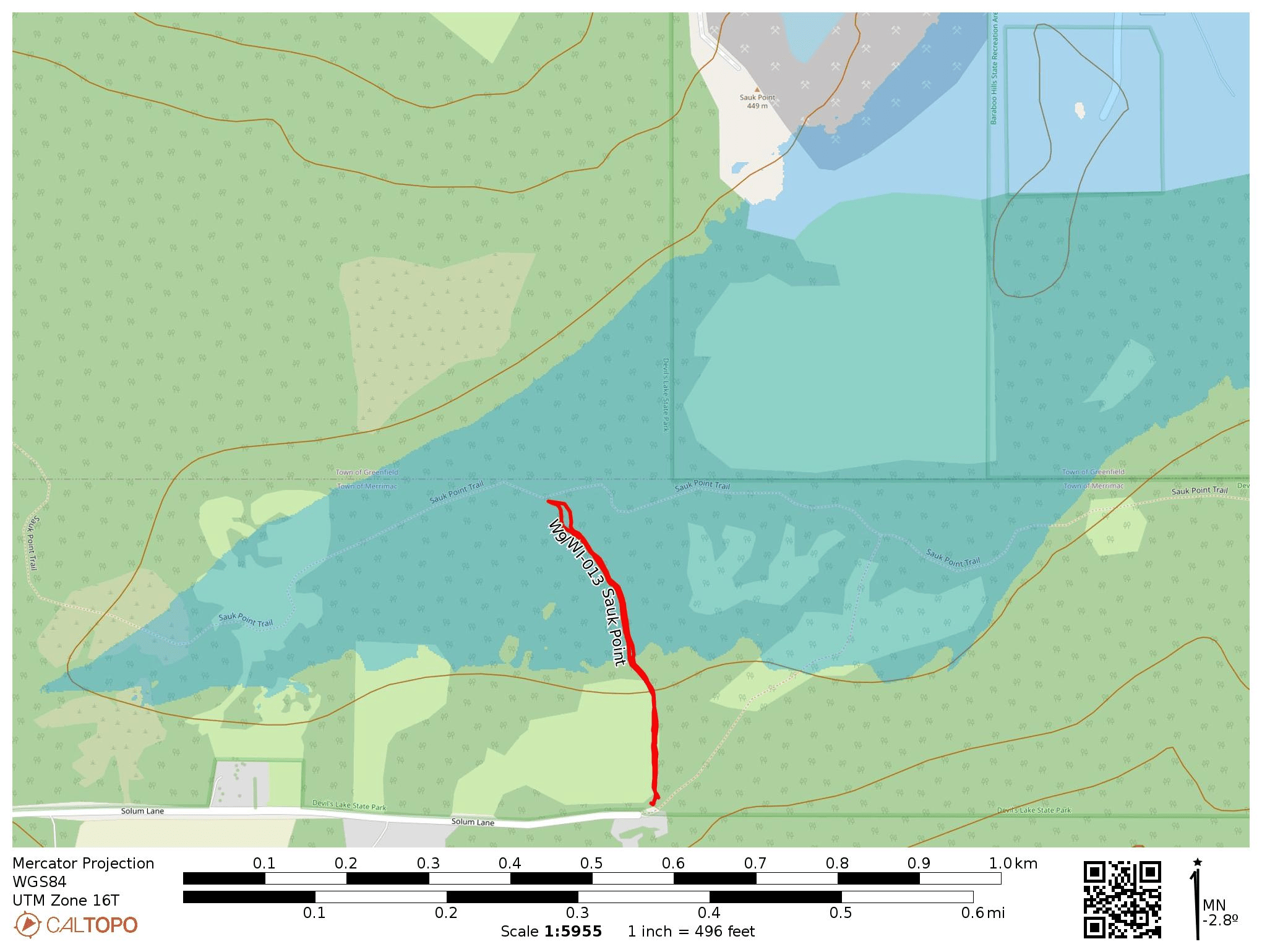
- Trailhead: 43.42023, -89.66053 : Sauk Point Trail Parking Lot at end of Solum Lane.
- Map: [AA3TZ SOTA] [Devil’s Lake State Park Map]
- Route: 0.5 mile RT hike on spur from Solum Lane parking lot to Sauk Point Trail
- POTA: US-1449 Devil’s Lake State Park; US-4238 Ice Age National Scenic Trail