W3/SV-025 Jacks Mtn 2184

Jacks Mountain is a long and narrow ridge that spans Huntingdon, Mifflin, Snyder, and Union counties. The mountain is named for Jack Armstrong, a pioneer and fur trader from the 18th century who confiscated a horse from his debtor Mushemeelin, a member of the Delaware who later tracked Armstrong down and killed him for retribution. There are a four sites that meet the SOTA 150m prominence requirements along Jacks Mountain:
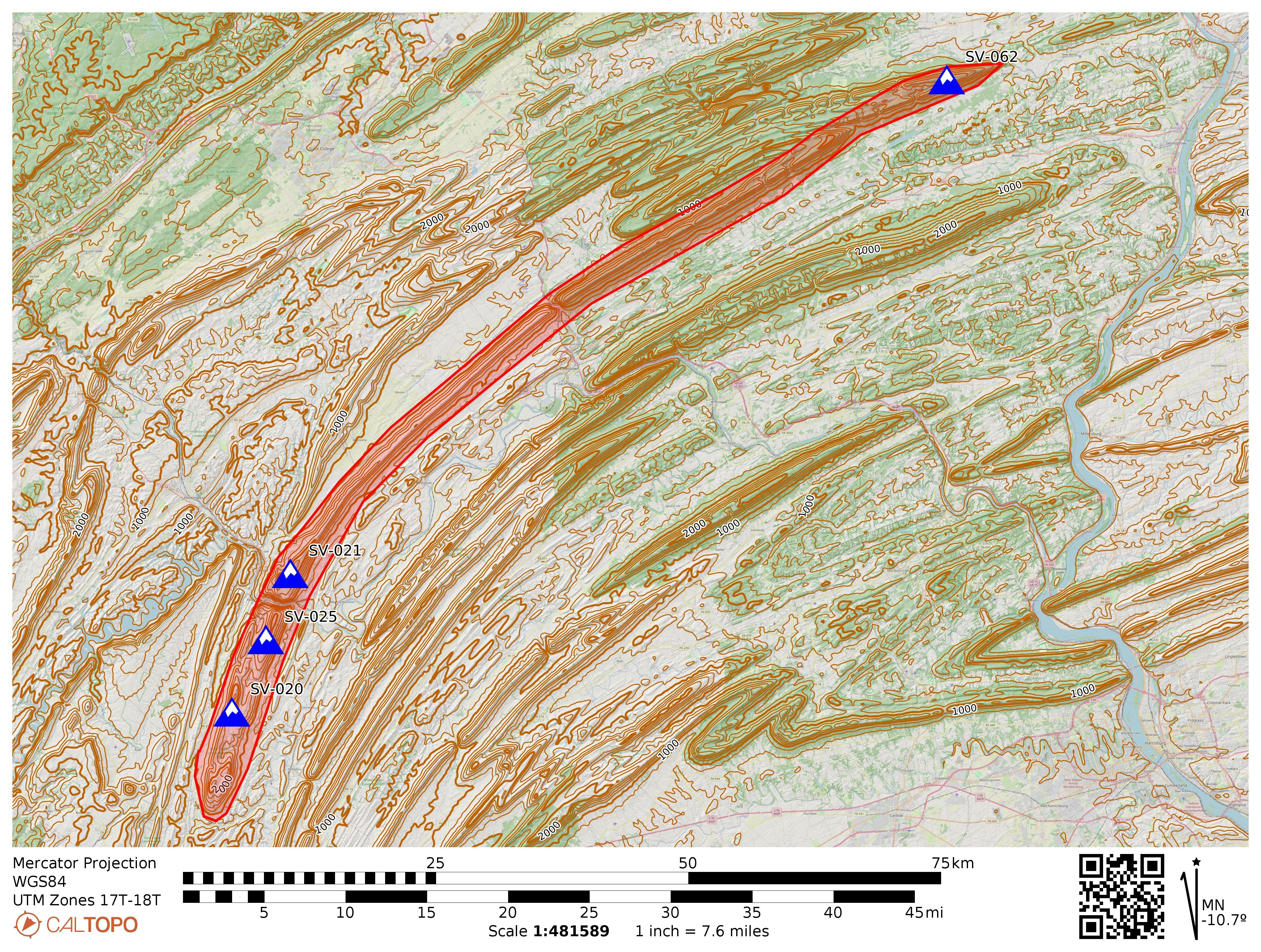
Jacks Mountain and its SOTA peaks. Jacks Narrows is between SV-021 and SV-025, following the Juniata River.

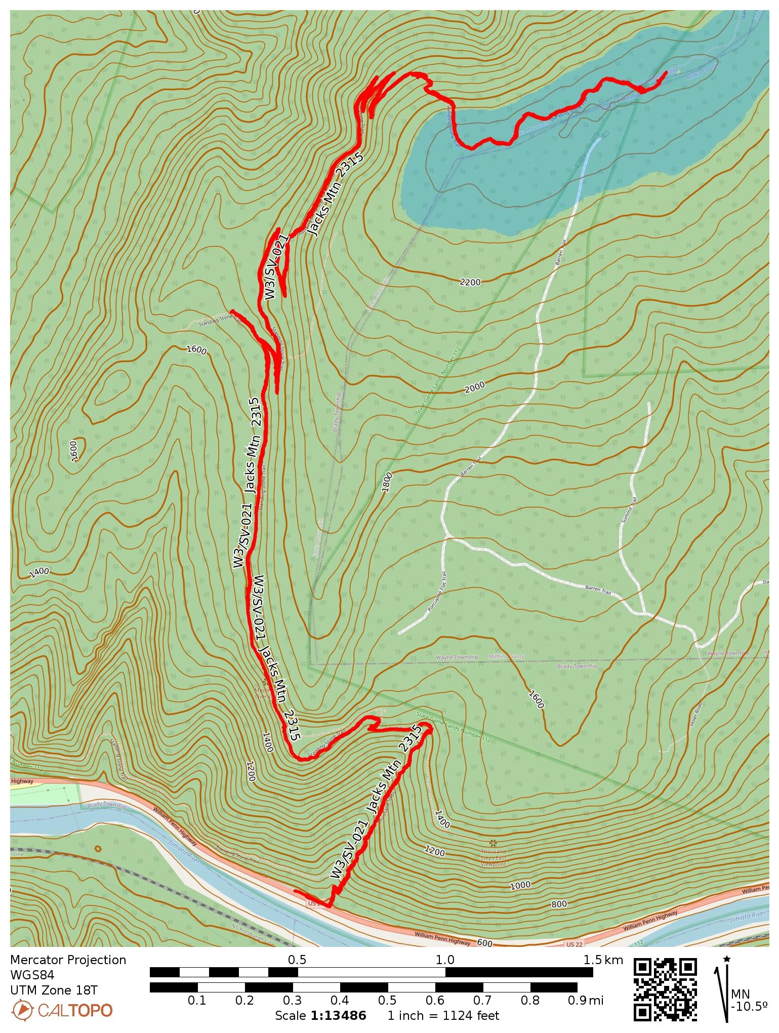
At several points, rivers have cut through the ridge, resulting in steep gorges. The Juniata River has eroded through Jacks Mountain between Mapleton and Mt Union, resulting in the steepest gorge in the state of PA: Jacks Narrows. The northern side of this glen features the Thousand Steps hike on the Standing Stone Trail, which I had used to activate W3/SV-021 Jacks Mtn 2315 last autumn on one of the most scenic hikes I’ve encountered in the state, with a dramatic gain of elevation climbing from the Juniata River valley all the way to the ridgeline.

Following the Standing Stone Trail south from Jacks Narrows leads to W3/SV-025, Jacks Mtn 2184. This is a classic “central PA SOTA usual suspects” activation, with only three logged activations before mine: N2GBR, NK8Q, and W3QP, which usually indicates a long hike and/or gnarly bushwhack ahead! Thankfully, it was just the former.

I had Luna along with me and this was the first of three SOTA activations we completed during this late March day. This one would require a roughly 6.5 mi RT hike, and I wanted to tire her out so she would be obliged to rest while I got my QSOs. I parked in Mapleton, but instead of parking at the SST designated spot in Riverside Park on the north shore of the Juniata, I drove to the south edge of town and parked by the side of Hill Road at a gravel spot (coordinates: 40.38953,-77.9422), cutting at least a mile from the RT hike. I left a note on my car that declared my intent to hike on the SST with my contact info in case parking here was frowned upon, but nobody seemed bothered.

My parking spot at 40.38953, -77.9422, just in front of a No Outlet sign.

Luna and I walked along Hill Road, passing the last few houses in this neighborhood before we found the trailhead to Scrub Gap Trail. This is all part of the Standing Stone Trail, so orange blazes mark the path the entire way.

Scrub Gap Trail is gated. The gate was closed when I started the hike, but it was opened when I had finished. Be wary of potential traffic driving to the reservoir along the route, though I missed seeing any vehicles on the road.

This hike up the southern side of Jacks Narrows was dramatic and varied, just not quite as scenic as the Thousand Hikes trail. After passing a water reservoir, the trail climbs through woods, mosses, and some vistas. This hike is a gradual climb, 1500 feet of gain over 3 miles. I did stop a bit short of the summit itself, as I was within the AZ with a more open forest to operate in at ~2130 feet ASL.

Close to the AZ is this trail junction. I did not go to Windy Vista, as the AZ was a bit further along the direction of Three Springs, at least 10 miles south of this point. As of June 2026, a lean-to shelter was built in Three Springs for SST through hikers as part of an Eagle Scout project.
I elected to operate in these open woods just off trail in the AZ. Luna watched carefully as I set up the wire.

Propagation was great this morning! I worked a bunch of locals on 40m, including NK8Q, VA2EO, KC1MXB, and N3HXZ, a small selection of my usual chasers. Then I got good amount of DX on 15m: HB9BHW, HB0CGA, SM5LNE, DL6MST, IN3KLQ, DK4DE, DL1AX, and PA5KM! After 40 minutes of patient waiting, Luna let me know it was time to go, so we started the long hike back. Two more summits were ahead of us today!
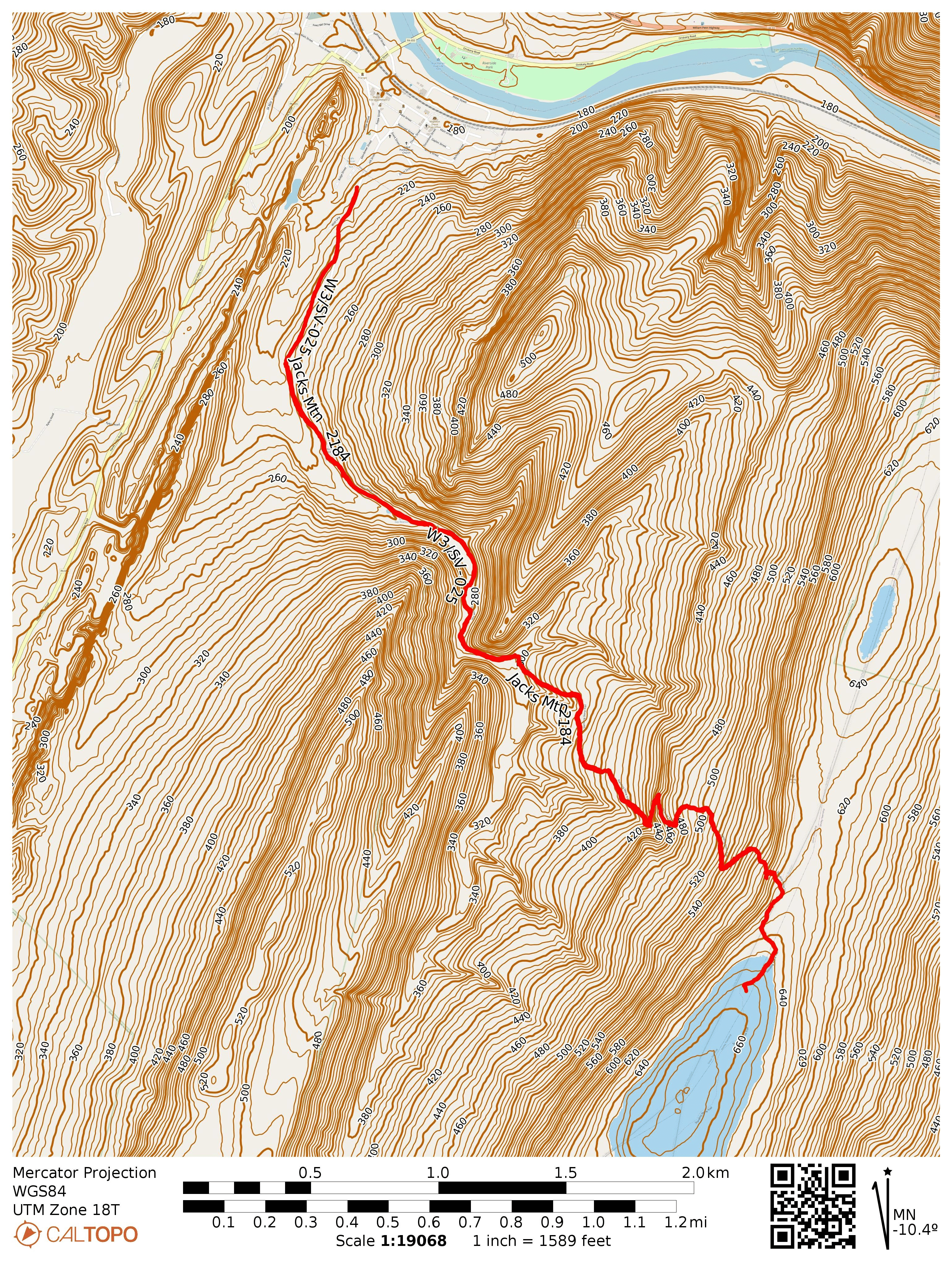
  • Trailhead: 40.38953,-77.9422 : Roadside gravel spot of off Hill Road in Mapleton
  • Map:  [AA3TZ SOTA] [SST Map 5 – Jacks Narrows]
  • Route: 6.5 mile RT hike along the Standing Stone Trail, Scrub Gap portion; ~1500 feet of total elevation
  • POTA: US-8770, PA 71 State Game Land

W3/SV-021 Jacks Mtn 2315

After camping overnight at Trough Creek State Park, I set out Saturday morning for what would prove to be one of the most memorable SOTA activations I’ve done in Pennsylvania. This was a 9-mile RT strenuous hike from the Juniata River valley up to an Appalachian mountain peak through beautiful and varied scenery across 1800 feet of elevation gain. This is what hiking and SOTA should be (sometimes)!

I ascended Jacks Mountain via the famous Thousand Steps Trail, a segment of the Standing Stone Trail. The name is quite literal. The hike begins with over 1,000 hand-laid stone steps climbing steeply up the southern face of Jacks Mountain (there are actually more than 1000 steps, fyi). Built in the early 1900s as a construction route for a logging and silica mining railroad, these steps have become an infamous Pennsylvania hike. The SST is well-marked with orange blazes, though access from the Rt 22 parking spot is via a yellow-blazed and rocky spur trail.

The morning was perfect for the hike. The first hints of autumn color were showing in the leaves. Every 100 steps are marked, so you know exactly how much you have left. This stair climb is about a half mile long, but involves 800 feet of elevation gain. It… was tough!

Once past the initial stair climb, the trail rewarded me with a much gentler grade. There were also very few hikers that continued past the Dinky Shed, so there was a warm feeling of earned isolation. The path winds upward through pleasant switchbacks, passing the Dinky Shed where seasonal workers would sleep while working the railroad. A short ways up was the Ledge Quarry Vista with a spectacular view of the valley I had just climbed out of.

The following section of trail was a welcome change of pace, allowing me to catch my breath and enjoy the forest. The trail passes through thick stands of mountain laurel, which must be absolutely stunning when they bloom in late spring. These long switchbacks were a bit of a slog, but I eventually was rewarded with the Mill Creek Quarry vista. I had been hiking with a couple from Harrisburg, PA through this part. They were both surprised that I was going to keep climbing after this vista, but when I explained it was for amateur radio, they surprisingly knew exactly what I was talking about! Turns out, they’re friends with an TikTok “hamfluencer” who does POTA on the regular in northern PA. I wish I had written down this ham’s callsign! They said I should get a TikTok, but I told them I write a blog, and one said “I respect that old school method.” These folks were my age, by the way!

As I climbed into the activation zone, the character of the forest shifted noticeably one final time. The understory opened up into a broad, mature forest with a beautiful carpet of ferns covering the ground. The summit area sits right on the boundary between State Game Land 112 and Rothrock State Forest, and the peaceful, open woodland made for a delightful operating location. I stopped just short of Shorbs Knob, which looks like a great operating point inside Rockrock SF. I doubled back to SGL 112 to activate a new POTA reference.

I had a successful activation too, lingering to enjoy the breeze through this magnificent forest, while working 36 QSOs. I did have to cut it shorter than I would have liked, since I had a first activation on the docket for the afternoon hike. SGL 112 might be the most interesting game land for hiking in the entire state! This is an absolute classic hike and I am seriously considering making this my MG summit. That’s still a long way from now, but I can’t think of a more interesting (and literally breathtaking) site. 🙂

  • Trailhead: 40.391979, -77.914790 : Parked at Thousand Steps Trailhead off to side of State Route 22. There is a portable toilet at the parking area, which is nice!
  • Map:  [AA3TZ SOTA] [SST Map 5 – Jacks Narrows]
  • Route: 9.0 mile RT hike along the Standing Stone Trail; ~1800 feet of total elevation
  • POTA: Two options: US-8811, PA 112 State Game Land; US-5474, Rothrock State Forest