
On March 13, 2026, I activated the four of the five DuBois Quintet SOTAs, and this was the second one of the day, after Jefferson County HP. It’s a drive-on site by a communications tower just outside of Moshannon State Forest, and the 2nd most elevated of the DBQ at 2369 feet ASL.
I had already activated this spot March 2025 when I was first visiting this area to learn more about the DuBois Quintet. I looked up some information about the mountain, and found out that there are some caves in Boone Mountain that some folks believe may contain a trove of gold bars. There is a legend that a Union wagon train carrying 52 gold bars from Wheeling, WV towards Harrisburg in 1863 was lost near Dents Run, PA, about 25 miles east of Boone Mtn. Since then, everybody from the Pinkerton Detective Agency to generations of treasure hunters to the FBI have searched for the missing precious bars. Some treasure hunters claim the FBI took the gold and claimed to have found nothing when they conducted their excavation in 2018. I didn’t look for any material treasure, but settled for the warm glow that comes from getting those SOTA QSOs!


When activating Boone Mtn, I prefer to walk away from the tower into the state forest along an ATV/hiking trail, as there is a pleasant trailside spot not far from the site, making this drive-on marginally more interesting, I parked next to a gate just a bit southwest of the communications tower, which blocks a road going to water utility infrastructure. From here, I crossed Boone Mountain Road (also known as Fire Tower Road) and and walked just under a fifth of a mile to a trail junction that has plenty of space to set up.

This time, there was a light dusting of snow on the ground. A large growth of mountain laurel is at this location, with new growth for the year starting to show. This would be a great spot to check out in early June when the laurels bloom!

On this particular activation in March 2026, I worked S2S with K2CPT on W2/GA-077 and JB KC1MXB on W1/GM-037, both on 40m, and WS0TA on W5N/SI-010 on 20m. I had worked JB already on the last activation (W3/PW-038 Jefferson County HP) as well!
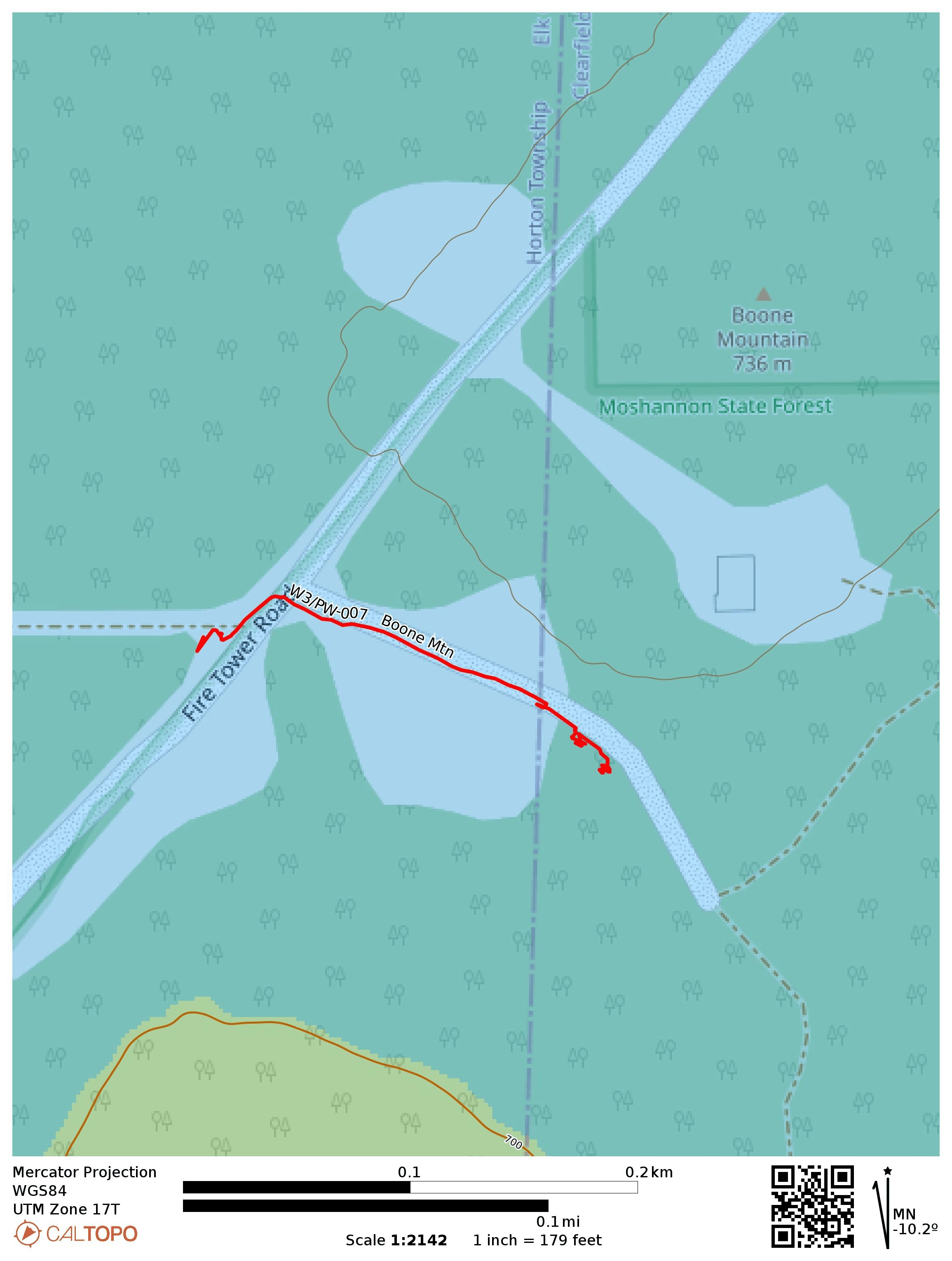
- Trailhead: 41.24571, -78.64861 : Beside gated access to water utility besides Boone Mountain Road
- Map: [AA3TZ SOTA] [Moshannon State Forest Maps]
- Route: Drive on; 0.2 mile hike along ATV trail into forest to get away from road.
- POTA: US-5472 Moshannon State Forest (though the peak itself is just outside the park)