
On March 13, 2026, I activated the four of the five DuBois Quintet SOTAs, and this was the first one of the day. The highpoint of Jefferson County is the fourth highest of the DBQ at 2169 feet ASL, and the county is where Punxsutawney (and Phil) reside. The peak is in State Game Land 54, which was once the site of the Ross Leffler School of Conservation, where wildlife conservation officers were trained.
Since I ultimately did 4 SOTA peaks in one day to maximize the winter bonus, I cut this hike short, not going all the way to the intriguingly named John Lennon Point Vista, though all reports indicate that it’s worth a visit if you ever find yourself in SGL 54.

I had activated this summit last year, but found a gate blocking Empire Ridge Road for construction/improvement projects. I had to park on the side Game School Road and hike nearly an additional mile each way. This time, the road was open and I could drive up to a large parking area at 41.29569, -78.87447 after which the road was gated once again. There are a number of parking areas to choose from in this vicinity, and the one at 41.29286, -78.87438 may shave off a few tenths of a mile from your hike. The gate here blocking Empire Ridge Road is open from late September through January for hunting season, so you may be able to drive much further down the trail if you come at the right time of year. Check out this map for more information on seasonal gates on PA SGLs.
Just over a mile into hiking along the road, you’ll need to make a turn onto the trail (41.30238, -78.85854). You might be able to park closer to this spot when the gate is open.


I stopped about a mile from the trail junction to operate since I was well within the AZ and had many more activations to do. The day started strong with two S2S: JB KC1MXB on W1/GM-037 and Mike WB2FUV on W2/GC-020, both on 40m. I would go on to work JB a second time on the next peak, the nearby W3/PW-007 Boone Mtn. Next time, I think I’ll just continue the extra half mile to see John Lennon Point, which is labeled with a stone marker and appears to overlook Little Toby Creek.
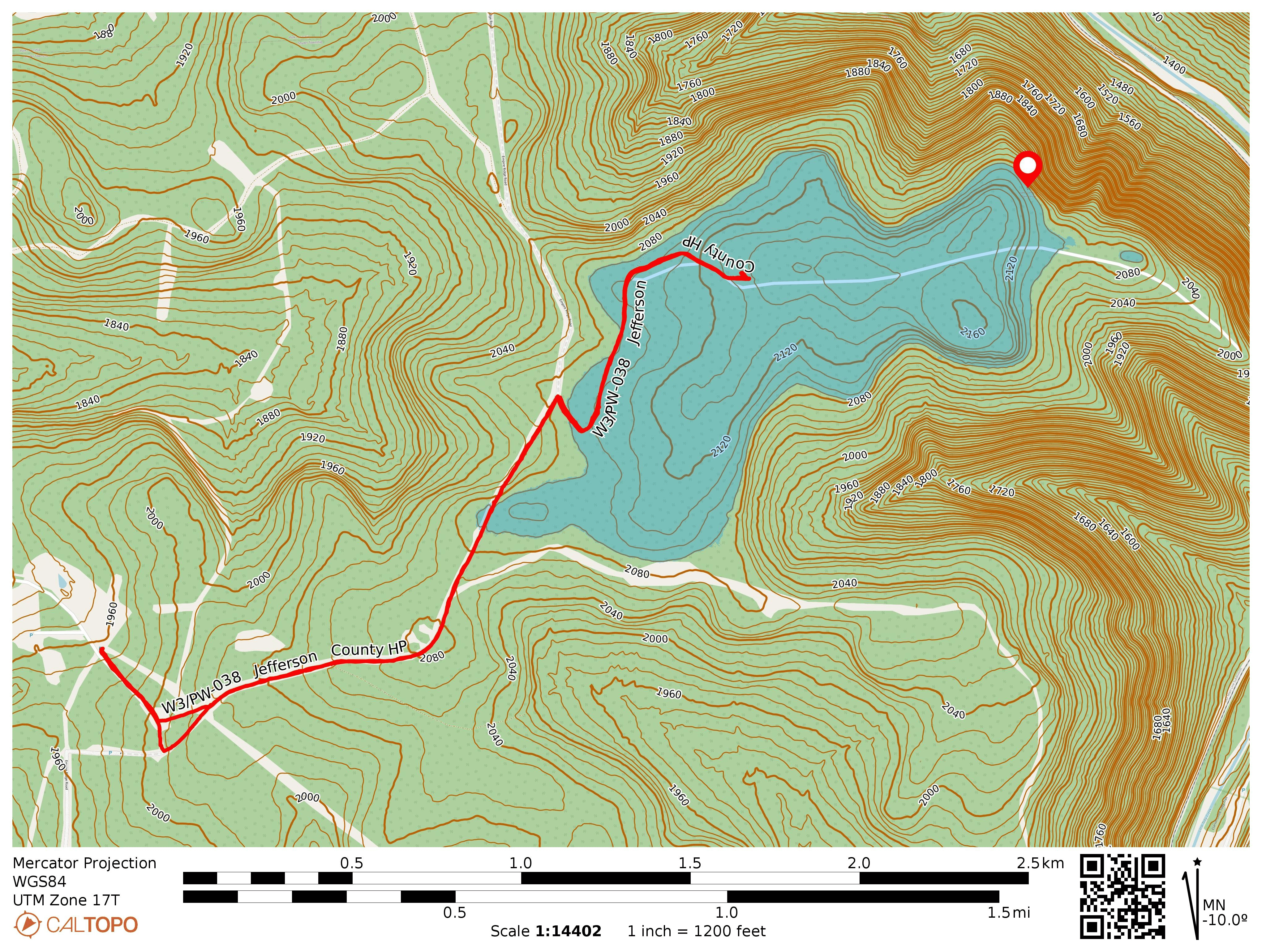
- Trailhead: 41.29569, -78.87447 : State Game Land 054 Parking Area
- Map: [AA3TZ SOTA] [State Game Land 054 Map]
- Route: 4.0 RT hike along Empire Ridge Road and an unnamed trail. Could drive further down the road during deer season to save time.
- POTA: US-8753 PA 054 SGL
2 thoughts on “W3/PW-038 Jefferson County HP”