VE2/ES-009 Mont Sutton

On the last day of my trip to Montreal, I had the opportunity to drive around the Eastern Townships of Quebec to try for three peaks. First on the list was Mont Sutton, which Eric VA2EO recommended I try for its views of the Green Mountains of both Quebec and Vermont.

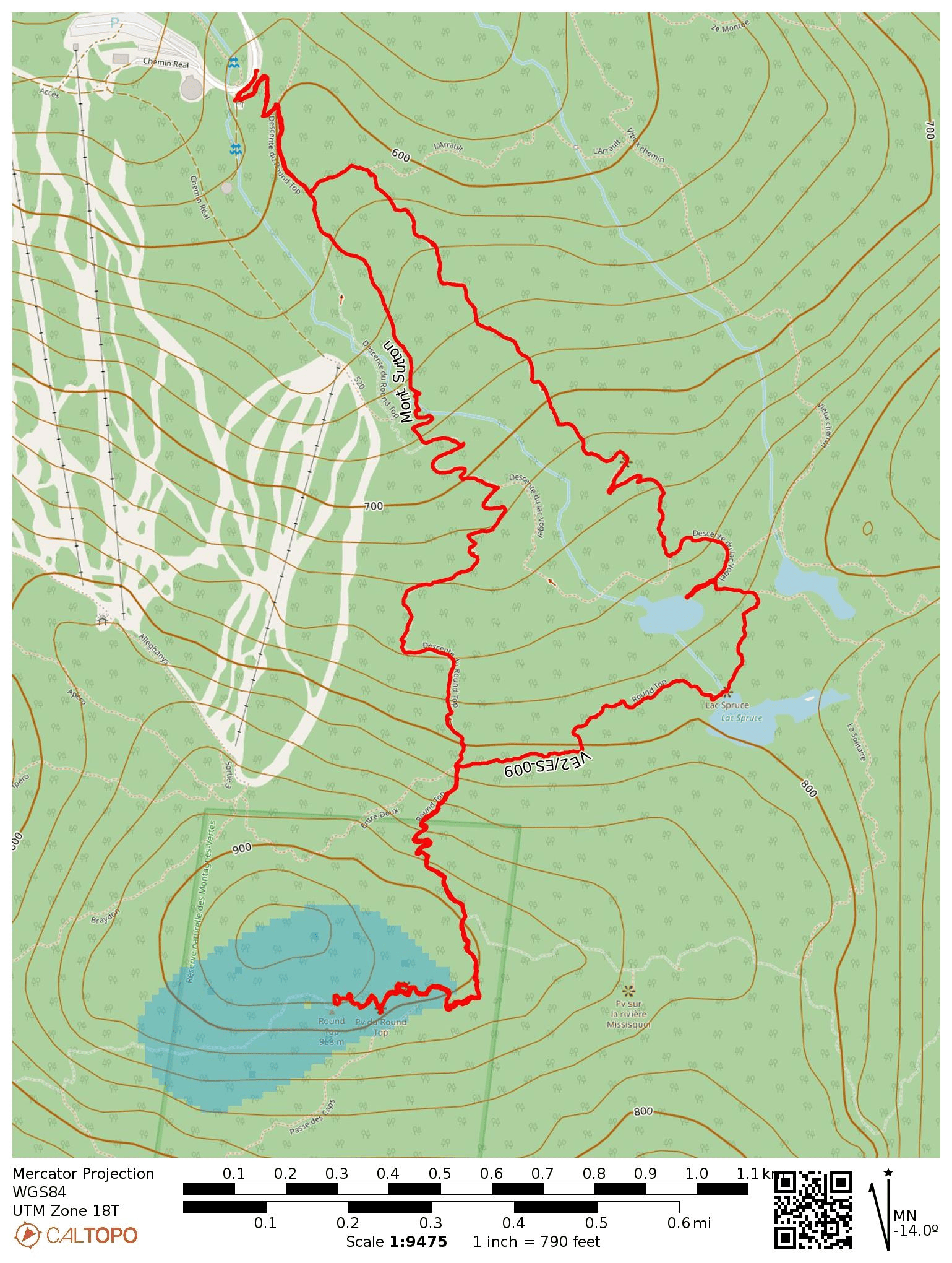
Nobody was present at the ticket booth to collect fees when I arrived early in the morning, so I’m not sure if an entry fee is normally required. The hike followed a one-way path that passed by a few beautiful mountain lakes, with separate trails for ascent and descent. The trail is well-maintained and there is plenty of signage to follow along to Round Top. Lake Vogel is a <0.1 mi detour that is well worth checking out!

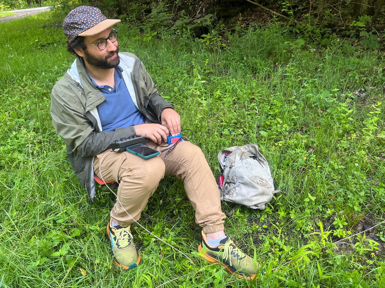
This was a significant climb, with over 1400 feet of gain, with a round trip hike just under 5 miles. Close to the peak of Round Top, I crossed over into the Green Mountain Natural Reserve, POTA CA-2158. I was able to tie my mast to a fence post and set up my radio on a rocky vista point. The mosquitos were huge up here!

This was a great hike! I highly recommend checking it out if you’re in the area. I had a couple more hikes to go, so I hustled down the mountain to drive to the next spot: Mont Foster.
  • Trailhead/Parking: 45.09728, -72.54833 : Parc d’environnement naturel de Sutton – PENS
  • Map: [AA3TZ SOTA]
  • Route: 4.9 mile loop hike, including an out-and-back spur to the peak. About 1400 feet of gain.
  • POTA: CA-2158 Montagnes Vertes Nature Reserve

W3/ER-001 Mercer County HP

I had been eyeing this SOTA peak for a long time, because it’s the only one in the W3/ER region. Activating it means finishing an entire SOTA region in one fell swoop. This would also be a complete since I have chased Nick WN2G on his activation last year.

Harry W3YJ, who manages University of Pittsburgh’s famous repeater and grew up in Mercer County, came along for a SOTA/POTA day. We drove up to the spot that Jody K3JZD recommends just to the south of Hendersonville Road. This gravel area is home to a gas tank and a couple roads go to trails around the area. This spot is already in the activation zone, so this peak is a drive-on. I got my wire up and started calling CQ.

Moments after scoring my 4th QSO, a small bulldozer pulled in. The guy driving it pulled by and asked what I was doing, and I gave the usual explanation and asked if he was the landowner. He said he owns some land nearby, but not land the high point is on. He added that “nobody really cares” if you hike around the trails there.

He was there to pick up an antique crude oil tank on his property and give it to a cousin of his who wanted it for her house. This region of PA, especially around Oil Creek, was the site of an oil rush in the 19th century. These tanks are common given the region’s oil boom history. There was a small family gathering getting this tank transferred to a pickup truck bed, and they did a good job – no fingers were crushed! Chatting with them, we learned that there are at least two plaques claiming to be the county high point in different spots.

W3YJ is a photographer for the Pitt marching band and football team and took some rare shots of me in CW-mode. He didn’t bring his fancy cameras, but he definitely knows how to get a good shot from a phone camera. I’m still learning how to use the Ham2K PoLo logger, but I’m liking how easy it makes uploading the log at the end of the day.

This was unusually eventful for a SOTA drive-on. Afterwards, we went to nearby Maurice K. Goddard State Park (US-1381) for a laid-back POTA activation at a picnic pavilion. Here you can see Harry and his portable dipole.

  • Trailhead/Parking: 41.31208, -80.05429 : South side of Hendersonville Road
  • Route: This is a drive on, but the actual high point is a short hike away.
  • POTA: None, though US-1381 Maurice K. Goddard State Park is not far away.