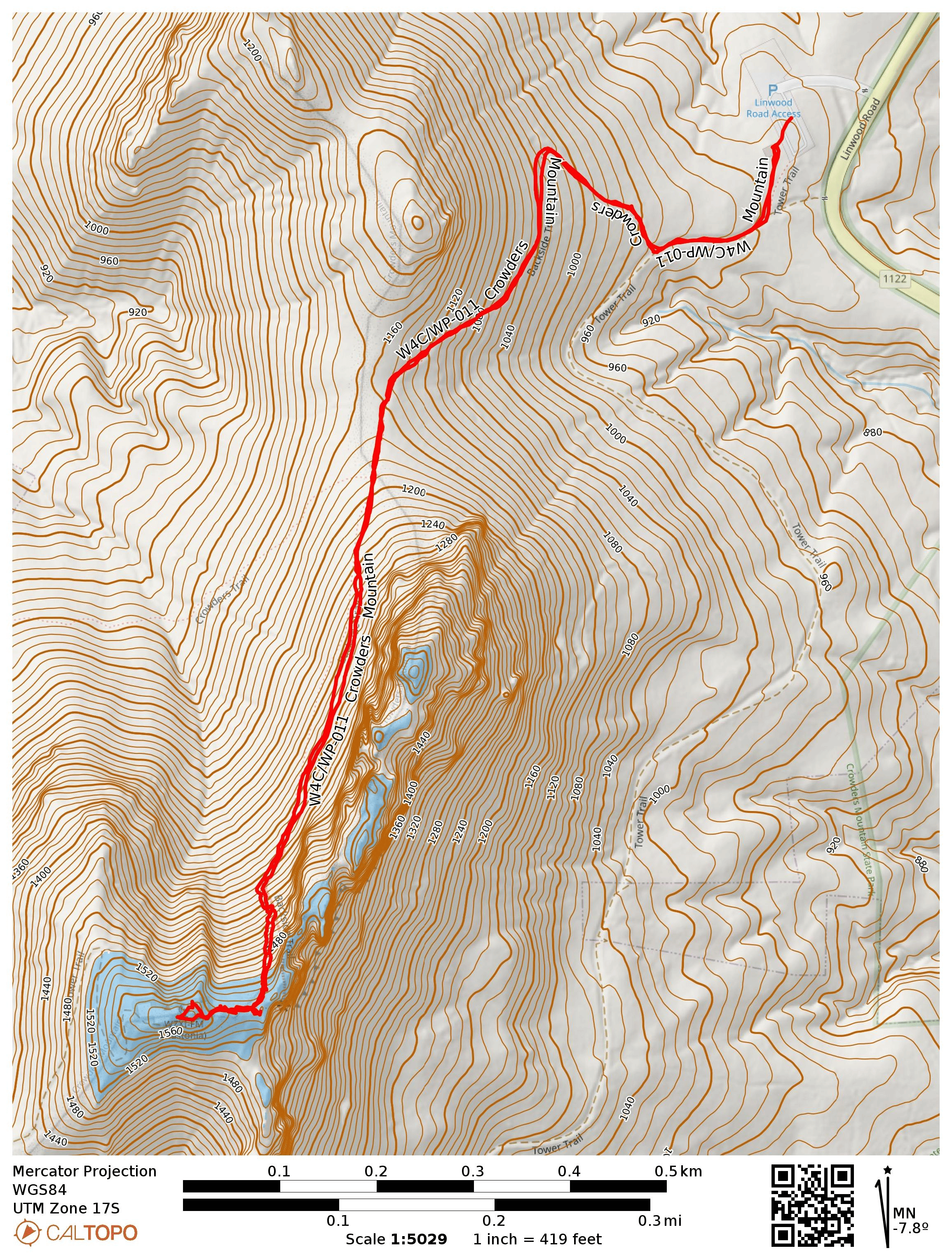
I had an evening to slip away from Charlotte to return and complete the second SOTA peak in Crowders Mountain State Park. Luna and I parked at the Linwood Road Access area and started up the Backside Trail, which is blazed with orange hexagons. The trail was still busy for a Tuesday evening, and we saw at least two dozen other hikers along the hike.
View of Crowders Mountain from Veronét Vineyards.
This one is a steep but short climb, about 0.8 miles to get to the rocky scrambles at the top. The last bit of the ascent takes you up a wooden staircase.
Looking down at the staircase.There is a warning sign here, and you should heed the warning. Some of the rocks drop down sheer cliffs suitable for rope climbing.Checking out the radio tower. I encountered a large amount of QRM on 2m.This rock is the edge ofa cliff. Very nice views with late evening sun lengthening the summit’s shadow.
I found a side trail that I could string my EFHW along and hunkered down with Luna for some operating. There was a strong breeze keeping things cool. I had good luck on 40m and 20m, working 28 QSOs in quick succession. The new UTC day was approaching quickly, so I decided to pack up HF after only 20 minutes, and called on 2m. I got W4MW again on FM from his QTH in Boone (I worked him on my activation of W4C/WP-010 The Pinnacle a couple days ago), but had trouble hearing anybody else as I was still close to the tower. I walked a bit further from the tower and was able to hear KO4AXL, who was mobile. That was it for 2m FM. I’m going to have to get one of those 2m BPF filters that N6ARA is about to release!
Trailhead: 35.24099, -81.26946 : Crowders Mountain State Park – Linwood Road Access
What good fortune to be in Charlotte, NC the day before a conference! My wife Stefanie KK6STE is attending too, along with our dog Luna, and it was crucially important to tire her out so we could leave her in our hotel room while we went out to dinner this evening. After getting her to sprint around a dog park in the morning, I took her on this hike in Crowders Mountain State Park, about 25 miles west of Charlotte.
This hike is a local gem, taking you up The/King’s Pinnacle, a monadnock of 800 feet rising far above anything else in the vicinity, with some light scrambling near the end. At the top, I was able to see the skyline of downtown Charlotte and the southern rim of the Blue Ridge Mountains, as it was a hot but clear day. This was a very busy trail on father’s day, with many families, children, and dogs all hiking up the Pinnacle.
The trailhead has a signpost with camping information. Just see where other visitors are walking if you go on a weekend, as they’re probably headed here.Crowders Mountain is SOTA peak W4C/WP-011, but there is a shorter hike from the Linwood Road access area. I elected to go with the Pinnacle today. I might be able to slip back for Crowders Mountain later in the week.
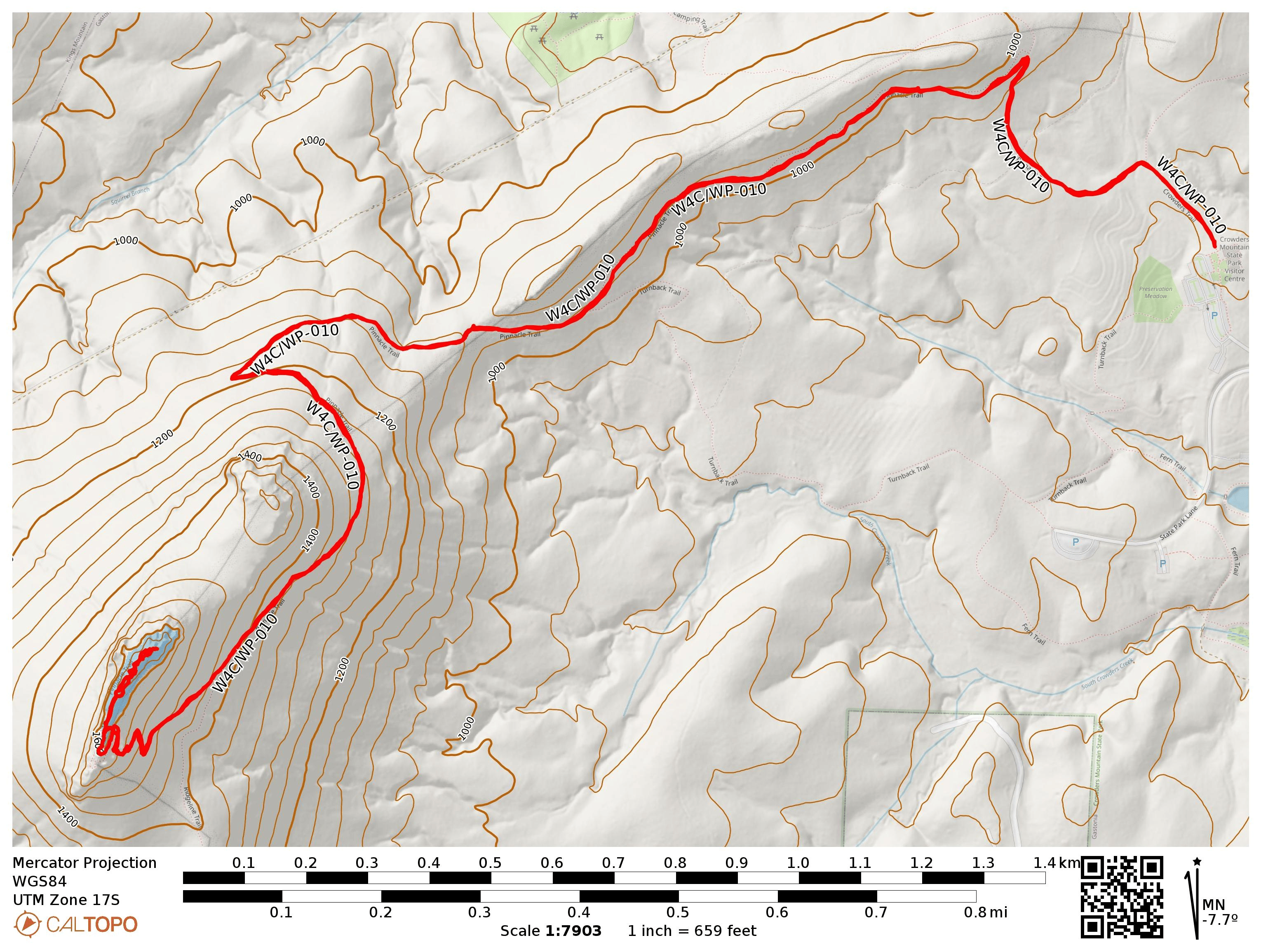
The hike starts at the Crowders Mountain Visitor Center, Sparrow Springs Access. Just off the parking lot is a trail towards the park’s campsites. Before long, there are helpful signs guiding you along the Pinnacle Trail, which is also blazed with orange circular reflectors. The paths are wide and well-used. Even with the heat and the just after noontime start, I probably passed by over 200 other hikers today on the just over 4-mile round trip.
Wide, well-worn dirt paths switchback up the mountain.
Close to the summit ridge, there is a staircase hewn into the rock, and then there is a junction. There are some scary signs to the right warning you about the pitfalls of rock scrambling, but there is an easier path up that requires less steep scrambling to the left. I took this way, and Luna had no problem bounding up and down the narrow, rocky paths.
Rock staircase means you’re getting close!If the climb up this rock face looks intimidating, just move to the left and you’ll find an easier way up.At the summit marker.Appalachian mountain’s southern rim was also visible. This wide, flat part is a popular place for group pictures.
It was a bit crowded here, but I took my time getting my EFHW at the edge of the trail with a less popular vista so I would interfere with as few hikers as possible. Luna huddled down in the shade with me, clearly pooped from all the activity. I brought my half-wave collapsible whip for my HT and managed four QSOs on 2m FM, which was amazing! Thanks to KM5E, KM4DWY, W4MW, and KD4RAM for the local contacts. I also managed three S2S, all on 20m: El K6EL on W6/NC-423 (Mt Davidson, where else?), W0XC on W0C/SP-058, and N4DD on W4V/GC-013.
It was FB getting some 2m FM QSOs in the log!You can just barely see downtown Charlotte from here.Luna was very tired!
Luna and I got up, dusted ourselves off, then rejoined Stefanie at the nearby Veronét Vineyards, where she was working on some writing for her dissertation work. Some helpful folks pointed out Crowders Mountain, which dominates the horizon.
View of the saddle of The Pinnacle from Veronét Vineyards.I took the Pinnacle Trail both ways. There is an option to extend the loop very slightly through the Fallback trail, so goes the track by KI4SVM.
Trailhead: 35.21350, -81.29362 : Crowders Mountain State Park Visitor Center
Laurel Caverns recently became PA’s 125th state park. I went to check out the cave tour and activate the park for POTA, then added a stop at Morgantown and Gregg Knob while I was in the neighborhood. Dan NM3A had recently done this peak, advising to drive along Greggs Knob Road to approach the peak (as Dale N3HXZ suggests) rather than White Oak School Road, since the latter is in poor condition. I did not have much trouble driving along Greggs Knob, about 1.5 mi of unpaved road driving, eventually parking by a gate in front of a field in the AZ.
While setting up by the side of the road, I tugged on my wire a bit too tightly and my EFHW snapped cleanly in two, right where I had stuck a center insulator. This shifted my 40m resonant wire antenna to a 20m resonant wire, no problem! This antenna was almost exactly one year old, having come with me to over 50 activations in that time. Now it was showing its age, the BNC connector starting to oxidize from its repeated exposure to snow, ice, and rain, but it was time to give this antenna its last activation.
On this Saturday in late May, I found a lot of folks driving by on ATVs and various off-roading vehicles. One couple drove by, asking if I was the landowner here. I just explained what SOTA was we talked a bit about the old ski hill that used to operate around here. They were here to gather rocks by the side of the road and really just wanted to know if I could give them permission to look for rock piles on the property. Alas, I could not!
Being a Saturday afternoon, a lot of folks were out activating summits, and half of my QSOs were S2S, all on 17m and 20m. KX0R on W0C/SP-070, N0DNF on W7I/SI-015 (a rare Idaho activation!), KC0DGR and W7UM on W0C/PR-118, WU7H and WW7D on W7W/KG-093, and KK7LHY on W7W/WE-010. I also used the KX2 tuner to work JB KC1MXB on 30m, but regretted not being able to work my regulars on 40m.
Trailhead: 39.50187, -79.53535 : Side of Greggs Knob Rd
And a couple pictures from Laurel Caverns SP, the last full activation for this antenna before it was truncated. I worked the activation from a service road and trail a bit down the hill from the parking area to be out of the way. Many folks visit the park!
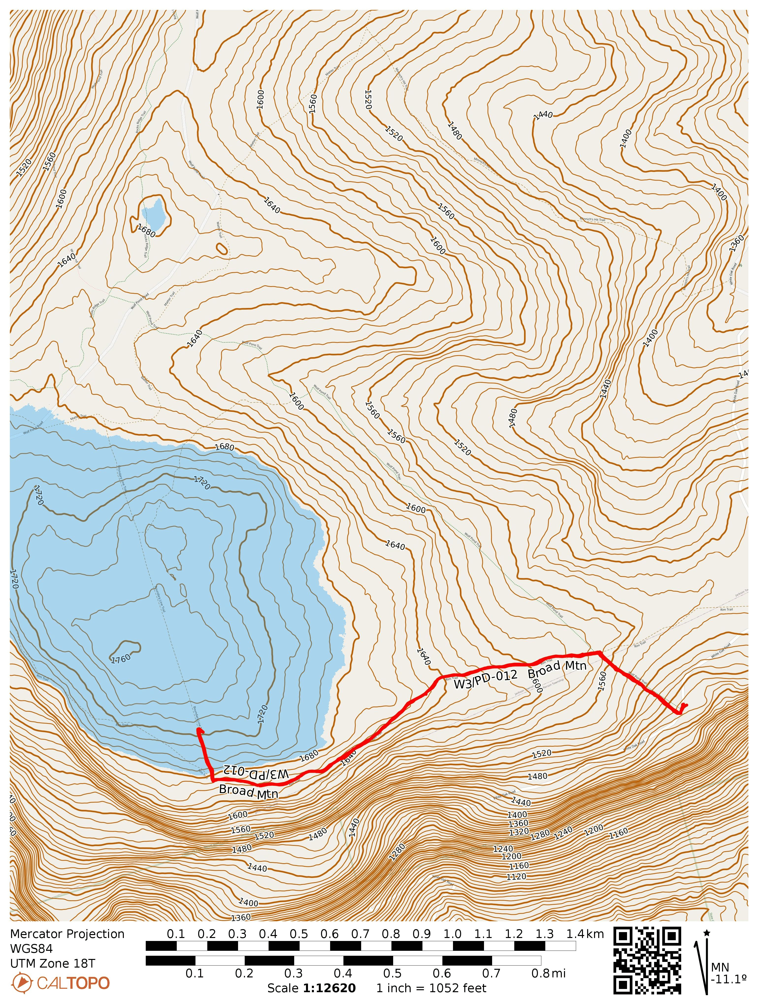
This was my last activation from a string of activations along Eastern PA. I parked in the Halderman tract of Weiser State Forest, arriving from White Oak Road. I parked here and took a short hike along Wolf Pond Trail and Rim Trail into the activation zone. An alternative is to drive south along Wolf Pond Road, a well-groomed gravel road that extends all the way into the AZ.
Trailhead for Wolf Pond Trail, which is marked with red blazes.Mountain laurel buds were visible and growing for the early summer bloom.The turn onto Rim Trail.
After a short walk on Wolf Pond Trail, I turned to follow Rim Trail west, which looked like yet another gravel road, though a bit more overgrown. After following this for the bulk of the hike, I came to Boundary Line Trail, a gravel path that sharply climbs up into the AZ.
The junction of Boundary Line and Rim Trails.
I set up along this road to operate. Here I worked S2S with AE0MM on W0D/BB-033, an unnamed peak in the Black Hills National Forest in SD, on 40m and KF9D on a second WI summit for the day, W9/WI-015 Happy Hill.
As you can see, Wolf Pond Road leads into the AZ from the north and is an alternative path.
Trailhead: 40.50944, -76.74986 : Parking area in Halderman Tract of Weiser State Forest
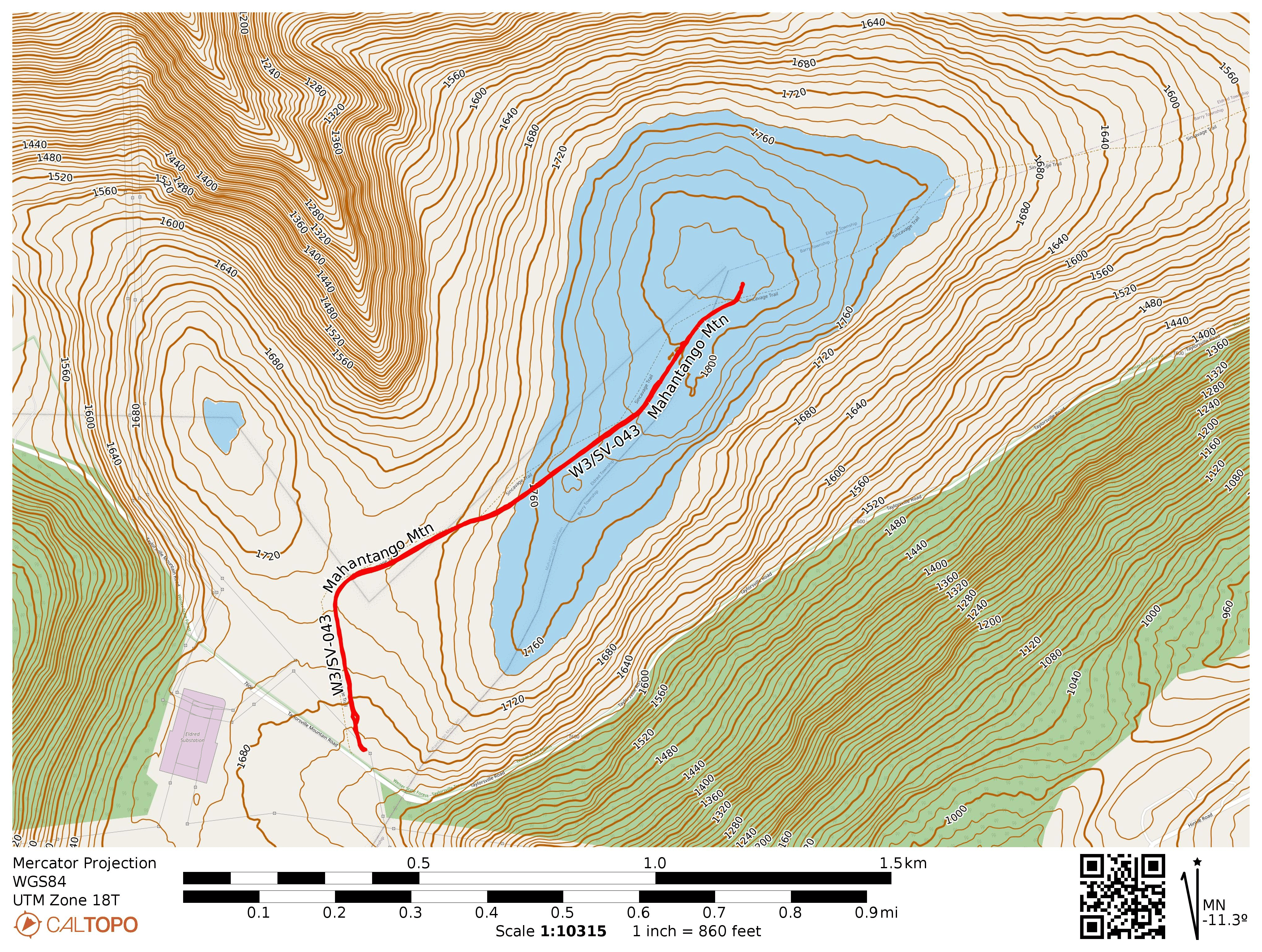
On my way back from Eastern PA, I stopped by Weiser State Forest for this short hike, not far from some high tension powerlines. I parked at the trailhead for the Sincavage Trail off of Taylorsville Mountain Road. This tract of Weiser SF felt very open, the trees not very tall or densely packed. The trail was really a gated gravel road and it probably was only about half mile to get into the activation zone, but I went on to get close to the actual high point.
Parked at the Taylorsville Tract where Sincavage Trail (more of a road than a trail) starts.This branch is very close to the labeled peak, and I activated along the road splitting off to the left (Black Gun Trail).
There was plenty of space on a side road to string a wire along and I enjoyed a calm activation. Two S2S QSOs to note: KF9D on W9/WI-013 Sauk Point on 40m and KX0R on W0C/FR-089 Cheesman Mountain on 15m.
Trailhead: 40.72839, -76.43737 : Parking in Taylorsville Tract at Sincavage trailhead
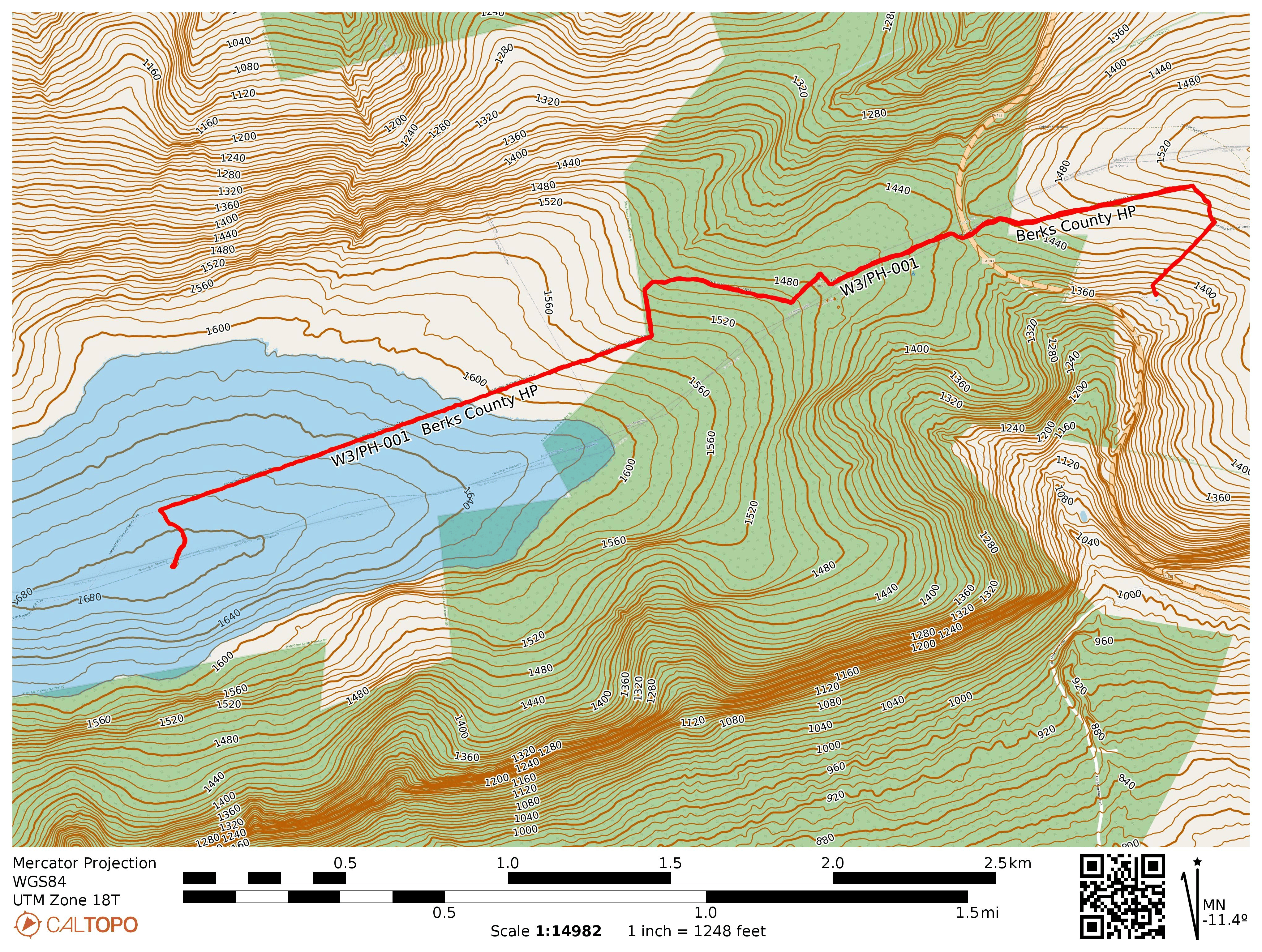
On the tail end of my trip to eastern PA, I took on 3 more SOTA peaks. This first one is one of just 5 in the W3/PH Philadelphia region of the state, along the Appalachian Trail. Most of my excursions on the AT are during off-seasons, early spring/fall, when serious through-hikers are well beyond the Mid-Atlantic portion of their journey. Being mid-May, I had my first encounter with through-hikers, with their huge packs and tree-trunk thighs built up over months on the trail.
I parked at a lot for State Game Lands 110 a quarter mile south on PA-183 from where the AT crosses the road. There is a small parking area in front of a gate at the trail crossing, but this is posted no parking. There is a lot of space in the SGL lot (at least 50 cars), and very little use on the day I was there.
After about a half mile, I made it to the road crossing. The crossing felt treacherous, but you just have to wait patiently for a good window. After that was a ~1.8mi hike along a straightforward segment of the AT, following the white blazes. The activation zone of the county high point extends to the AT, but I wanted to go to the summit itself. A side trail called the “Caleb Frantz Memorial Trail” leads to the high point, marked with yellow blazes. This short jaunt ends at a very rocky pile in the middle of the forest with a signpost, US flag, and mailbox complete with summit register, declaring you have arrived at the high point.
The last entry in the register was from over a week before, so this must not be a popular side hike for most AT hikers. I enjoyed the solitude, working HK3W in Colombia, VO1AW in NL, DL9NCI in Germany, and F4WBN in France, all on 20m.
Trailhead: 41.41221, -78.33270 : SGL 110 parking area
Route: 5.3 mi RT hike, 300 feet elevation to the high point itself, though the AZ extends quite a bit.
POTA: US-8779, PA 080 State Game Land
On the hike back, I ran into a tall through hiker from Houston who went by the trail name “Big Bird.” He had been on the trail for nearly 90 days with his wife (I did not get her trail name). He was a bit ahead of her so we chatted for a bit to slow the pace down. Big Bird was impressed by all the historical markers around PA, and hung out until we got back to the PA-183 crossing. I also saw a turkey hunter in camo face paint silently stalking down the road as I walked along the gravel road back to the parking area. Guy was in the zone — he didn’t even wave.
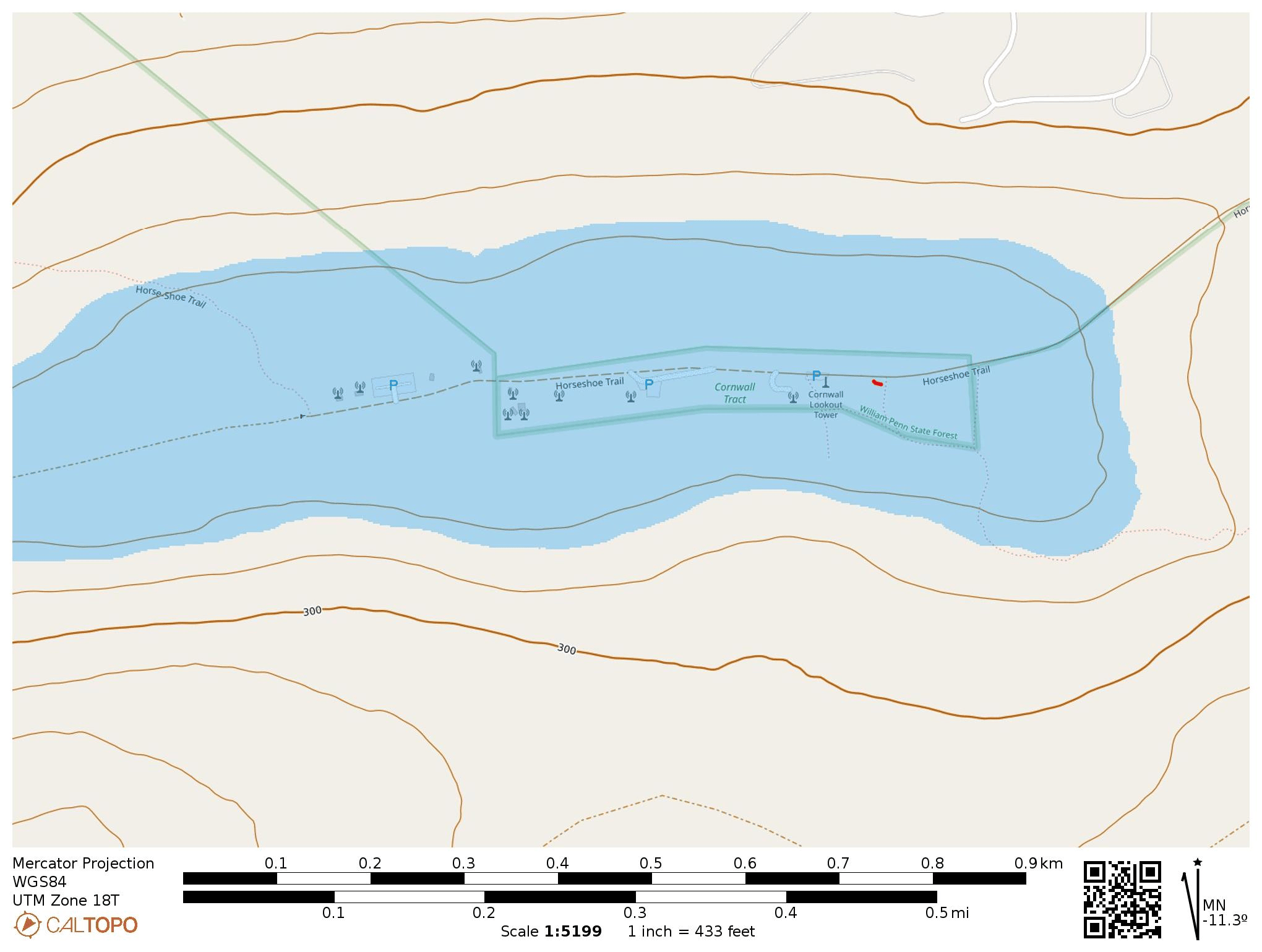
I got out for an early morning activation of Cornell Lookout near Lancaster, PA before my day-long workshop in Elizabethtown started. The drive into the site was uneventful, following Horseshoe Trail, which is a paved road(/riding trail?) with many patched potholes dotting the asphalt. While driving up, the right side of the road is posted private property, and everything to the left is part of State Game Land 156. I parked at a pullover inside the activation zone that is within the tiny 10 acre Cornwall Tract of William Penn State Forest. This tract was purchased from the Cornwall family in 1935 for $1.00.
I parked and operated at this spot on the left. The road is in good shape up to this point, but gets rough a few hundred feet past this point.
I got on the Lancaster Radio Transmitting Society’s repeater on 145.390 (PL 118.8 Hz) to try to drum up some locals for 2m. I connected with John W3RC who was driving in the Poconos. I don’t get out to eastern PA too often, but I know that the Poconos are very far away, so I confirmed with John that the repeater is part of a linked network. After chatting a bit, I set up my EFHW for HF activation by the side of the road, just after 6:30 am local time.
I was happy to get 17 QSOs before the anticipated rain started to roll in. I packed up and continued driving west along the road to see the Lancaster radio club’s shack and the other antennas on the peak. The road was in very bad shape, with large potholes, the further I went, but careful driving got me there. I recommend staying on the paved part of the road as it’s in better condition.
Lancaster Radio Transmitting Society’s site is next to a SGL 156 parking lot.
This is an easy 1-pointer drive-on to add to a trip to Hershey, PA. This was also my 40th SOTA complete, as I chased KE8OKM on his activation back in 2024. I’m surprised that it hasn’t been activated since late 2024. It would have been good to reach out to the LRTS with a bit more lead time as they seem like a good group to know, and their club is on the peak as well.
Trailhead: 40.24119, -76.37037 : Pullover south of Horseshoe Trail
I stopped by Michaux State Forest on my way to Elizabethtown, PA to activate this SOTA peak. My last trip to Michaux SF had been a winter hike on the Appalachian Trail to activate W3/PD-007 Snowy Mountain at 2090 feet. This companion peak at 2110 feet is just a bit taller, part of the north half of the forest. These two are the most-activated peaks in the Pennsylvania Dutch region, and I had chased this one one three occasions! Activating it would add another complete to my “collection”.
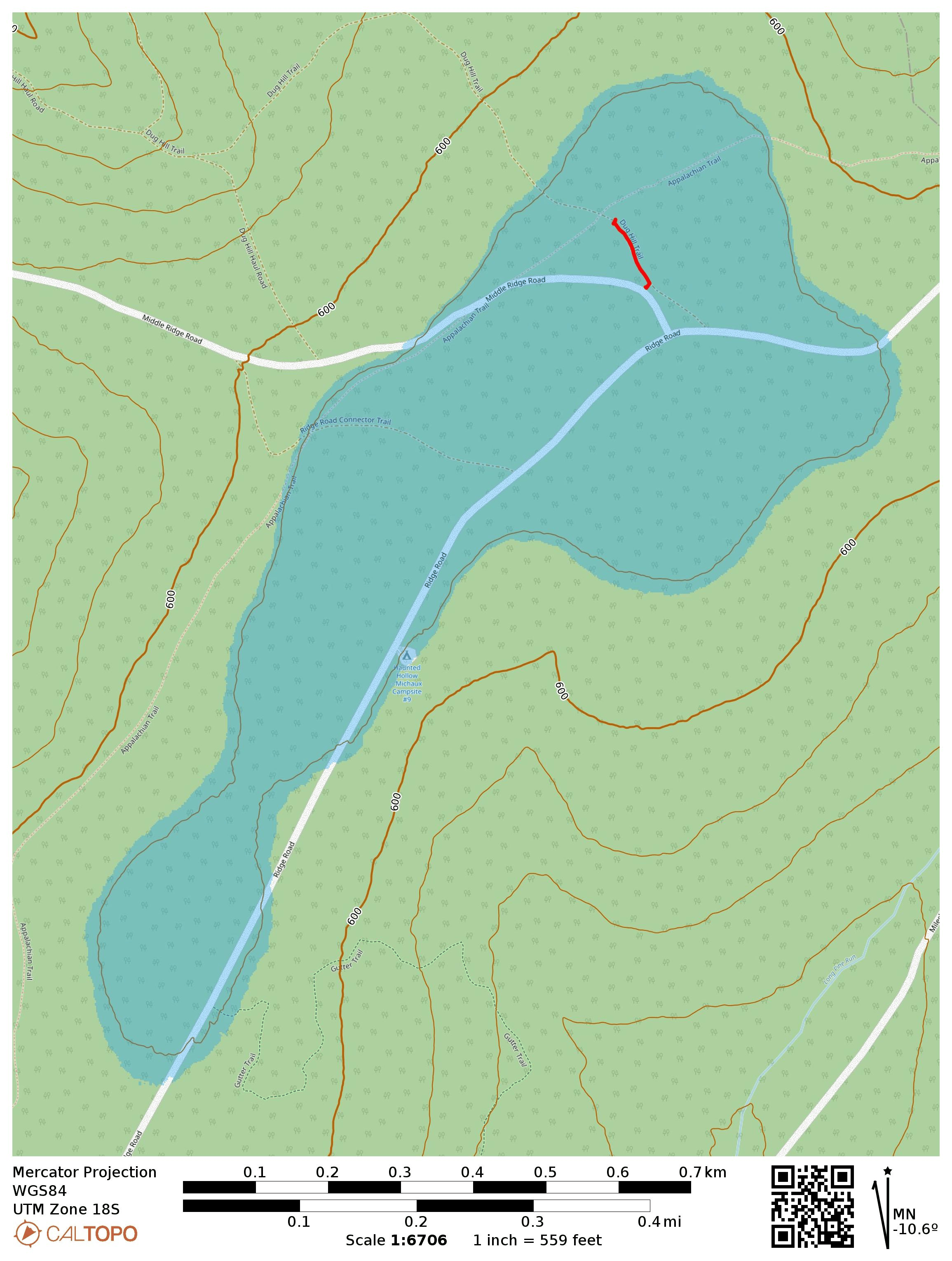
This is a drive-on and the Appalachian Trail goes through the activation zone. I drove along Ridge Road, turned onto Middle Ridge Road and parked where AC3B recommends, on a small grass patch large enough for one car. Here, a trail called Dug Hill Trail starts. As far as I can tell, it’s a short connector/mountain bike trail that gets little use. Critically, it passes right through the AT. I walked down this trail, admiring the little mountain laurel buds starting to bloom, until I got within 100 feet of the AT so I could activate it for POTA as well.
The turn on Middle Ridge Road is marked with this sign and the parking spot is just past it and off to the right.Dug Hill Trail starts just past the parking spot.The first mountain laurels are starting to flower!Peeking at the Appalachian Trail for good measure.
I set up my wire along the trail and got calling. Conditions were more settled after yesterday’s minor geomagnetic storm. I managed to get a couple S2S, WW7D on W7W/SNM-163 and AC7MA on W7W/CW-061. The Pittsburgh area SOTA afficionados tried to connect on 40m, but had trouble hearing me. I tuned my KX2 to 60m and managed to work Dan NM3A with a very strong signal, both of us using ~9W. He was using a 160m Carolina Windom antenna while my KX2 tuner got my end-fed 40m inverted vee to 2:1 SWR. I also was able to hear N2GBR, but he could not hear me. This has got me thinking about how to better weave 60m into my standard operating procedure now that the best days of Cycle 25 are behind us and it’s a long decline ahead.
This makes 39 completes! I have my eyes on Cornell Lookout near Lancaster for my 40th complete tomorrow, but it’s looking like a wet morning. I think I’ll stick it out — it’s not often that I find myself in eastern PA!
On the way back from my yearly trip to Ohio for Xenia Hamvention and Cincinnati to visit my folks, I detoured through Chillicothe to try some new-to-me SOTA peaks documented by Chris N8PEM: W8O/SE-012 1225 and W8O/SE-016 1190B. Both of these nameless peaks sit in Tar Hollow State Forest northeast of Chillicothe. I did not see any logging activity/traffic on my trip, but this was the last week of turkey hunting season in OH, which led to an interesting encounter!
W8O/SE-012 1225
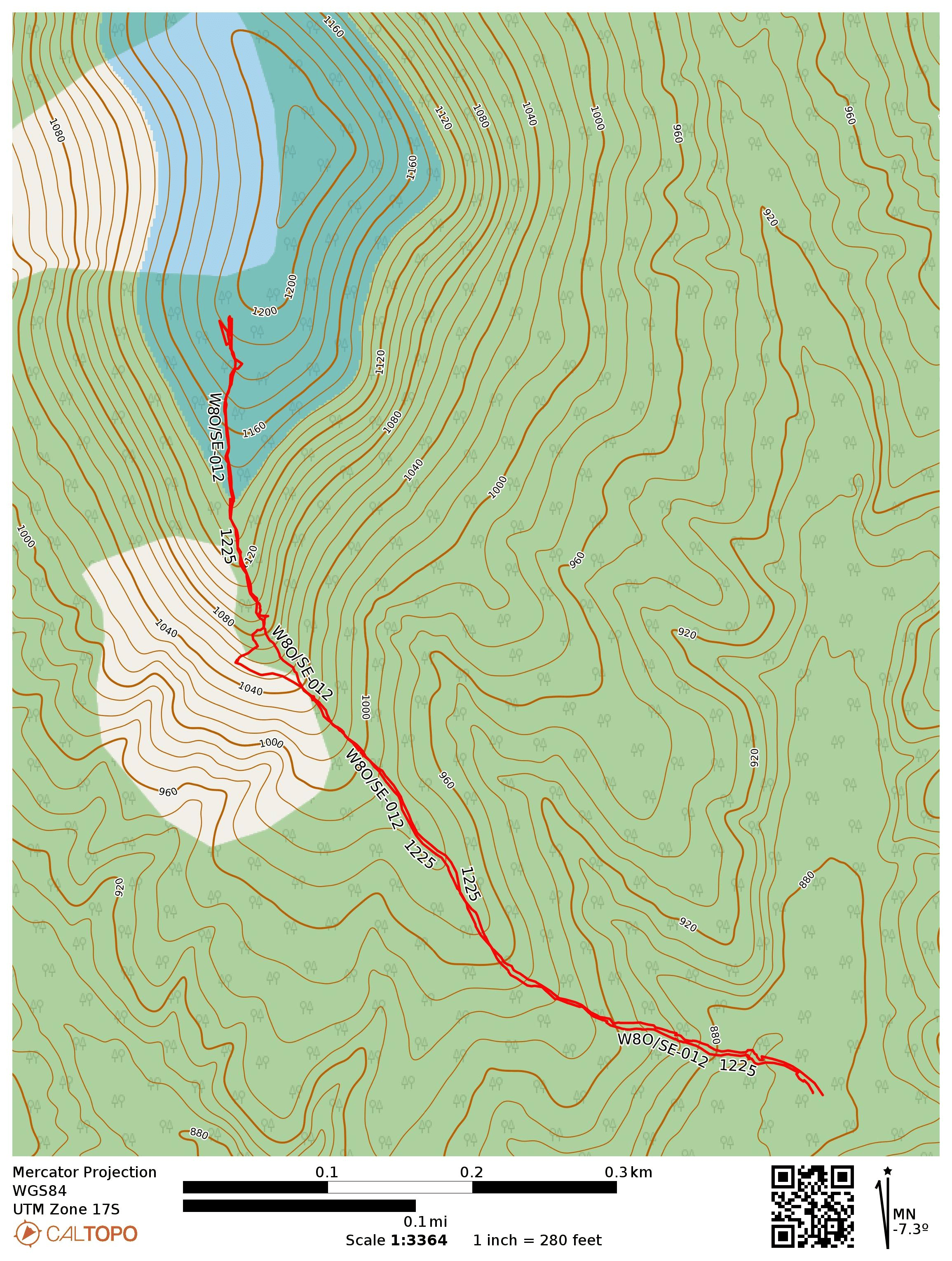
As suggested in N8PEM’s and KC8JPZ’s reports, I approached this site along Bunn Road. Once it enters the state forest, the road is unpaved, just like in PA. The gravel road had weeds growing in the crown, and should probably be tackled with a high clearance vehicle. I turned onto Park Road 12 to the trailhead, which has plenty of space to park off the road.
The overgrown path starts right from the parking area. Convenient!The path is easy to follow, if a bit green.
The path is an overgrown ATV trail that is fairly easy to follow, despite the growth. It crosses a creek/ditch, and then gradually climbs up into the activation zone. There are a few downed trees that have to be crossed near the beginning of the trail, and closer to the top, thorny briars cross the path. The trail got so overgrown that I thought the only way up would be to bushwhack (reader: the trail is there. Stick with it!) All in all, this is much better and faster than pure bushwhacking! About a half mile into the hike, the path ends in a large clearing and it’s an easy spot to get a wire up.
Turn around near the top for some views of the rolling hills.There is a clearing in the AZ that is a good spot to operate from, but there are ticks!
I noodled around a bit on 40m, enjoying a relaxed pace, getting 27 in the log in the end. I did try 15m to round things outd, but I don’t think band conditions were too great, with a K index of 5. I managed to work F4WBN and DL9NCI on 15m for DX.
I didn’t bring my permethrin-treated clothes on this trip, so I had to flick off a couple ticks when I made it back to the car. I’m starting to know what a tick crawling across my leg/hand feels like! Their little legs are sharp, and they start charging fast when they realize you found them!!
Trailhead: 39.39943, -82.81673 : Pullover in front of ATV trail by Park Road 12, in the Ruffed Grouse Management Area
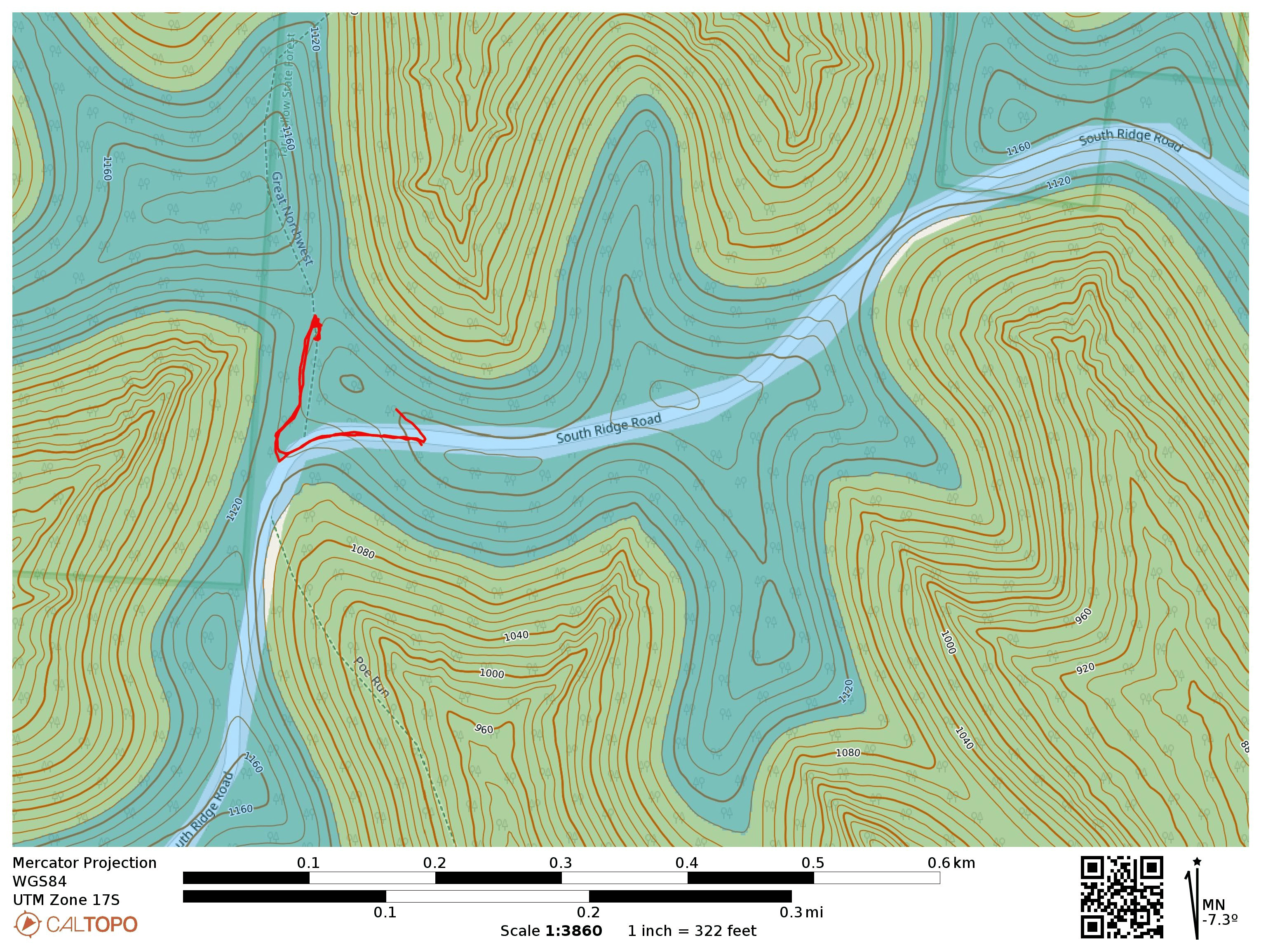
This one is a drive-on, with the high point on South Ridge Road. I drove on to park on a side gravel road. This would have been a convenient place to set up, but another car was parked there. Instead, I took a short walk down the road to the Bridle Trail until I found a log to sit on. The trail was marked with green blazes.
As I had finished setting up, a father and his two teenage children walked by, all decked out in ghillie suits. The kids, a brother and sister, were each holding a camouflaged shotgun, confirming that they were looking for turkey before the season ends on Sunday. They passed by me and the log, continuing north on the trail, no doubt going to where the turkeys were. Despite growing up in Ohio, this was the first time I had seen hunters in the state. Tells you something about where I usually hung out!
The parking spot.Bridle Trail is blazed green.The log for sitting. I used PoLo for logging.
Since it was 11 am local, I started on 20m, working Gary W0MNA and Martha W0ERI, the SOTA duo that I had just met at Dayton! This was now the 53rd time I had worked both of them on an activation. That’s over a third of all my summits! I worked the same DX as on the last summit, F4WBN and DL9CNI, just this time on 20m. They sounded stronger on 15m, but still good copy. After some time on 40m for the locals, including KF9D who is one of the 11 activators who has done this peak before, I packed it up with 23 in the log.
I didn’t hear any firearm discharge the whole time, so perhaps no turkeys were harmed today.
Trailhead: 39.34548, -82.79135 : Gravel road that meets South Ridge Road
Route: Drive-on. I walked just about 0.1 mi into Bridle Trail (green blazes) to find a log to sit on in the AZ. The zone is large, so there are many potential operating locations.
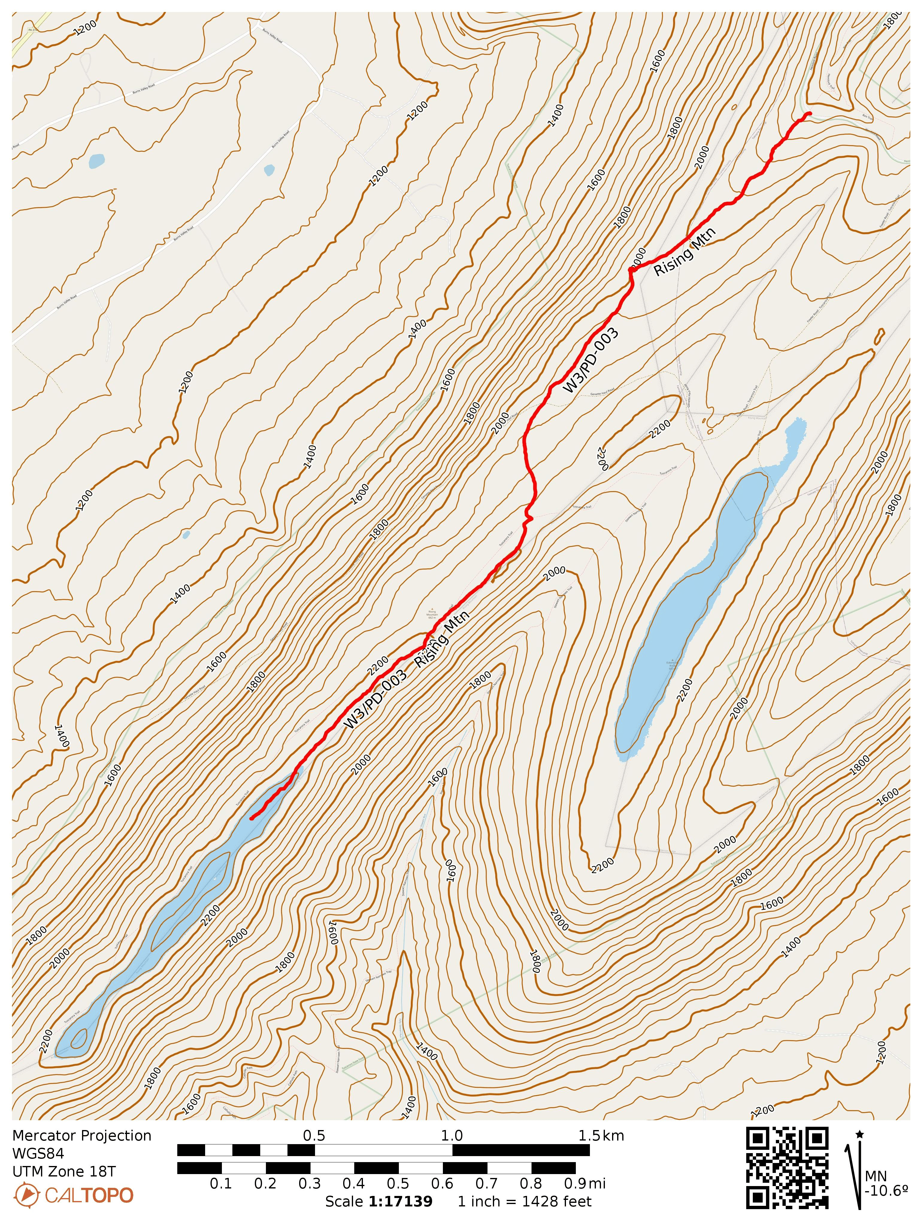
After my activation at Blue Mtn, I drove north through Tuscarora State Forest, past Fowlers Hollow SP, to Hemlocks Natural Area, an area that KC3TVC reports as “excellent wilderness.” I agree! This is one of the more scenic SOTA hikes I’ve done in a while. I walked north along the Hemlock Trail into the 120-acre old hemlock forest for a bit to take in the large trees, and then returned to the parking area to start the hike south on Bear Ponds Trail towards Rising Mountain, which lies on the Tuscarora Trail.
I followed the red-blazed Bear Pond Trail for a half mile through some mountain laurel and young forest until I joined the blue-blazed Tuscarora Trail.
From here, the path got a bit rockier, following the ridgeline of Rising Mountain. Along the way I passed a local who was excited to see somebody else on the trail, and we chatted for a bit. I suppose Tuscarora is not one of the more popular long-distance trails. It’s 250 miles, so I’m not sure that many folks attempt to through hike it.
After a little over 2 miles, I was in the activation zone and found a small clearing by the trail to set up and operate. I managed to work JB KC1MXB on 40m for a second S2S, this time on W1/AM-350. My other S2S was on 20m with K6EL on W6/NC-298 in Berkeley, CA, my third S2S with El on my beloved Vollmer Peak.
Trailhead: 40.23508, -77.64443 : Hemlocks Natural Area parking
Route: 4.5 mi RT hike on Bear Pond and Tuscarora Trail, 500 feet gain.
POTA: US-5479 Tuscarora State Forest
After this hike I camped at Colonel Denning State Park, where I got in an evening POTA activation. The next day was a rainy morning, so I just found some picnic groves in nearby Fowlers Hollow SP and Big Spring SP for a couple more POTA activations on the way home. Big Spring was particularly pretty, and there is an abandoned railroad tunnel to check out on the next visit.