
This peak has only been activated 12 times before my trip, which is surprising given that it’s only 20 minutes away from W3/PT-001 Mt Davis, the high point in Pennsylvania. The summit itself is on private property, but there is a path to the activation zone completely on public lands, through State Game Land 271. Dale N3HXZ and Jim KJ3D had recently tried this path out, and so I felt confident going for it myself. This time, I brought out my MTR3b v4 (the Currahee) for its first SOTA activation, along with a 40m EFHW tuned for deployment as an inverted vee.


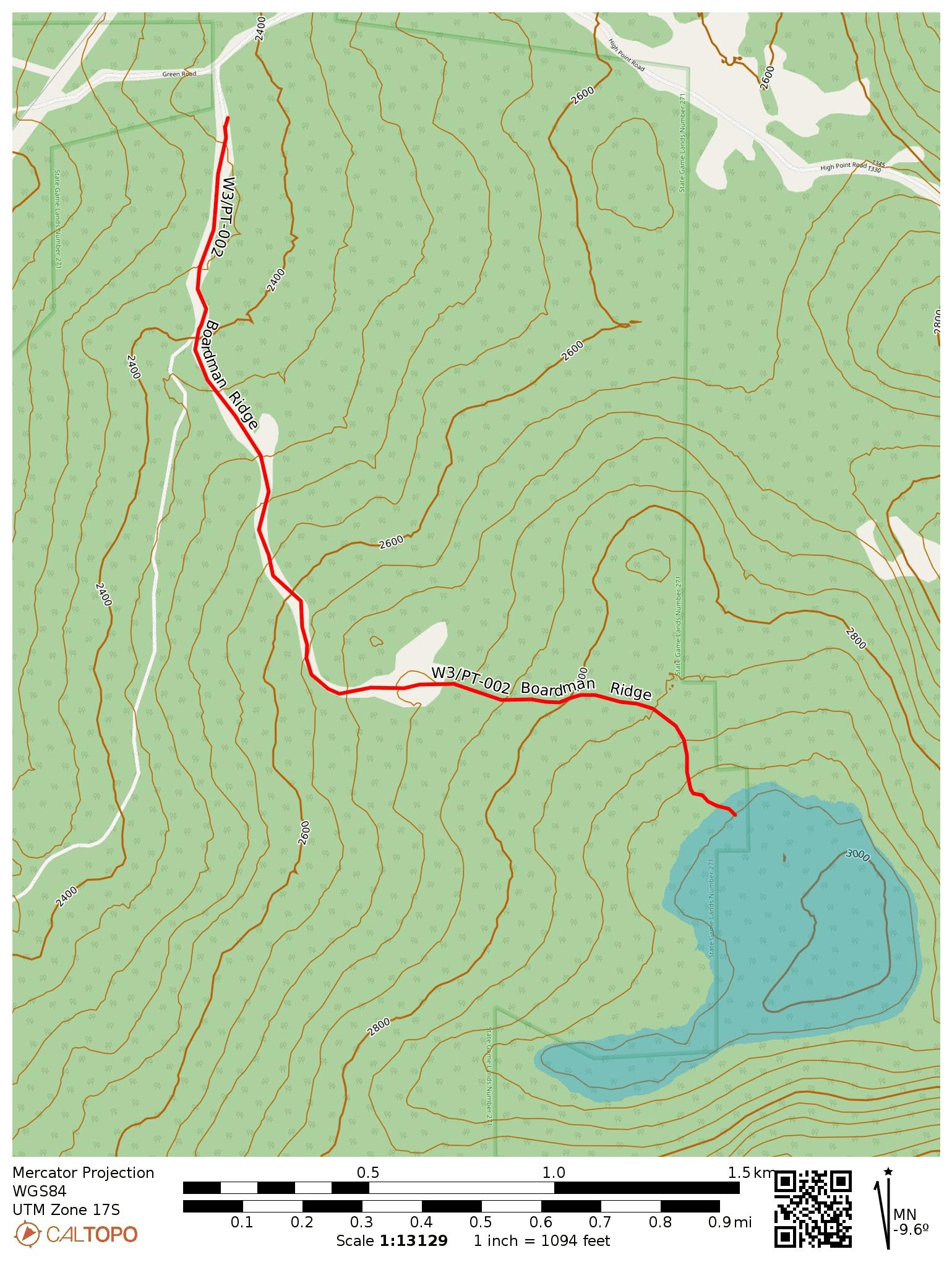
The initial hike from the gate in the parking area was no problem, and followed a dirt road. A little over a mile in, the trail opens up into a large clearing and it becomes more difficult to find the the trail. From here, you basically need to walk east and follow the easiest path that takes you to a higher elevation. The state game commission map for the area was last published in 2012, and indicates a road should continue east from this clearing, although it appears that the state has let this road be reclaimed by vegetation. If you attempt this in the summer, make sure to take all tick-related precautions you can. I finally got around to treating set of hiking clothes with permethrin, so I felt confident trudging through the taller grass.


I did lose the trail a couple times, but the last 0.25 miles were going to be a bushwhack regardless. I just used my compass to help me continue moving east and generally followed the hill up. Just at the edge of the game land, where it overlaps the activation zone, was a good clearing to set up and operate. The inverted vee worked well, but I also think the bands were cooperating this morning! A porcupine ambled through the forest about 20 feet away from me as I was working, and it was huge! I didn’t get a good picture, unfortunately.


I scored 31 QSOs in about an hour on 40m and 20m, including three S2S contacts: KC1ONG on W1/NL-004 in New Hampshire via 20m, K2JB on W4V/GC-018 in Virginia via 40m, and AA4K on W4T/SU-068 in Tennessee. I really enjoyed using the radio and am puzzled by its negative reception among some commentators online. Most complaints seem to single out the LED screen, which I could see becoming hard to read in direct sunlight. Since western PA hikes usually have tree cover (and the sky is often overcast), I feel like that isn’t going to be a problem in most cases.
This hike is worth adding on to nearby Mount Davis, which is a drive-on. I did just that!
- Trailhead: 39.78370, -79.26640 : State Game Land 271 Parking Lot. I had to take it slow for the last few tenths of a mile, as the road was pretty rough.
- Map: [AA3TZ SOTA] [PA Game Commission Map] – The last portion of my route is approximate, as it was a bushwhack.
- Route: 4.0 mile RT hike. Roughly 0.5 mile bushwhack.
- POTA: US-8966 PA 271 State Game Land
One thought on “W3/PT-002 Boardman Ridge”