
This post was originally written in December 2016. I returned to activate again in May 2025. Scroll to the bottom for the update!
I was in Cincinnati, Ohio on Christmas Eve’s Eve and decided to get in one more SOTA activation in Ohio. Even though Cincinnati itself is quite hilly, nearly the entire state north of the city was pressed flat by large glaciers during the last ice age. As a result, the majority of Ohio does not have much in the way of dramatic topography. In spite of these crushing efforts, the high point of Hamilton County is still about 12 km north of downtown Cincinnati near the neighborhood of Mount Airy, and is worth one activator point.
There are a number of radio antennas that take advantage of the region’s prominence, many of which are seated on top of a castlelike pair of water tanks nearby. A church parking lot next to the water pumping facility was within the activation zone, so I tossed a wire up into a nearby tree to get started on the most urban of my SOTA shenanigans.
This parking lot is near a busy street, so it should have been no surprise that a couple of people walking by were suspicious of the guy huddled in the grass with a wire in a tree sketching gibberish on a yellow notepad. I made sure to explain that nothing nefarious was going on here – just some good old-fashioned amateur radio. They seemed impressed that I managed to contact stations in California, Arizona, Colorado, Idaho, and Florida.


This was a fast activation for me. The required four QSOs were finished within the first five minutes on the air. Thanks to the chasers (and some of the usual suspects) who put up with my rushed QRP CW!

Update 17 May 2025: At Xenia Hamvention this year, I learned that this peak is colloquially known as the Taco Bell parking lot SOTA. Sure enough, just across the street from the Mt Airy Tanks is a Taco Bell. Adam K6ARK put it this way: “When you have the opportunity to activate from a Taco Bell parking lot, you take it!”
The activation zone is massive, and 3.5 miles north of the Taco Bell down Colerain Ave is the Farbach-Werner Nature Preserve, a 22-acre Hamilton County park. Roughly half of the park is within the AZ, and it’s better for your gastrointestinal health to hang out here than at TB. The park technically charges a Hamilton County parks entrance fee ($8 day pass, $16 year pass), but nobody was around on this busy Saturday morning to check, and it wasn’t clear if anybody does check at this small park.


The sun must have downed a few of its own version of chalupas this morning, as a minor geomagnetic storm (Kp ~5) was brewing. I spent some time trying to work the activators in the Catskills for the W2 campout, but could only work a few S2S: AC1Z on W2/GC-105 (30m and 17m), and WB2FUV on W2/GC-042 (20m). I only got 5 QSOs this time, and that includes working AC1Z twice… Still, this was a pleasant place to activate, with plenty of park benches to sit at, and I recommend checking it out!
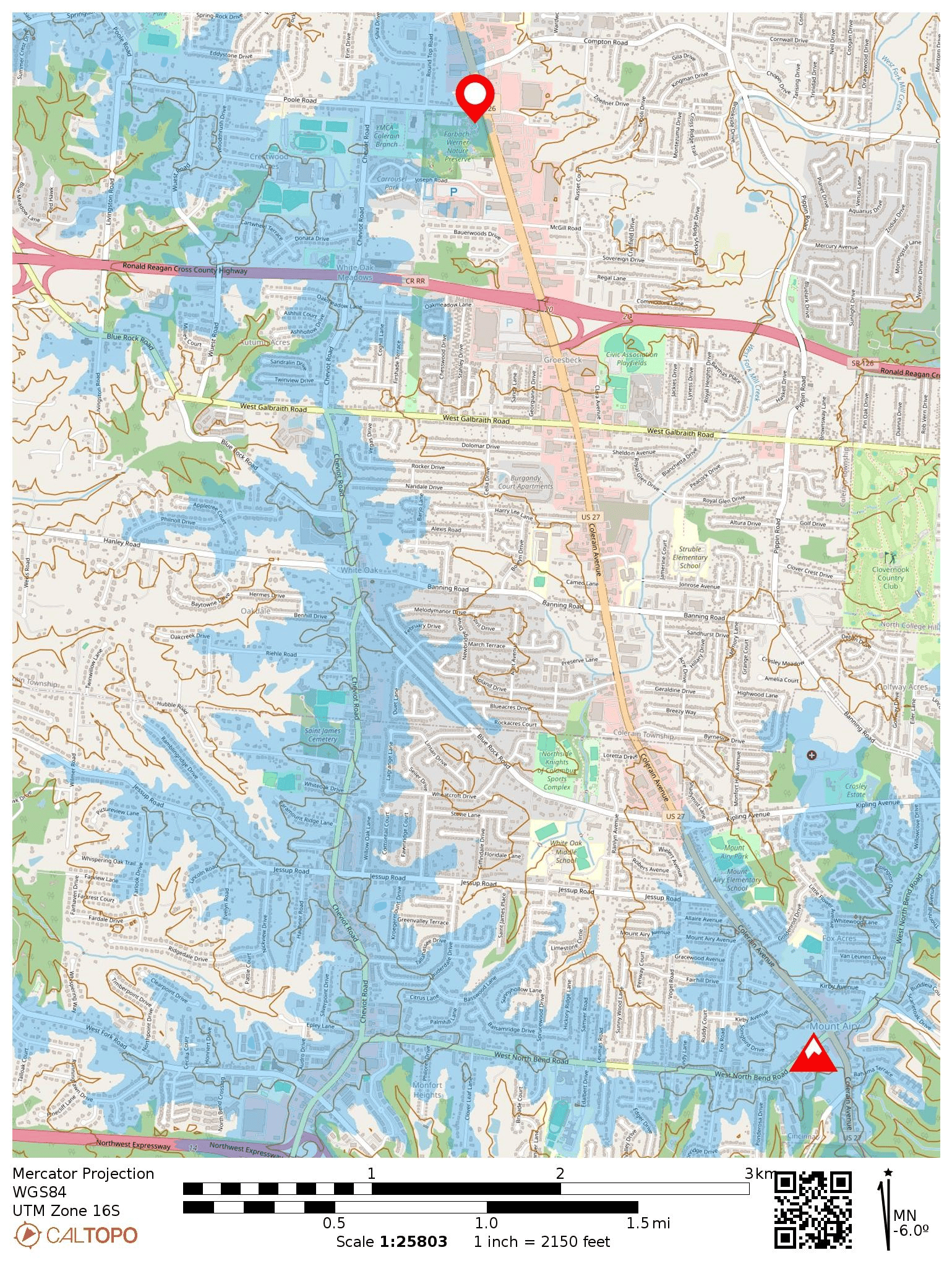
The large baja-blast-blue region is just a fraction of the activation zone. The peak is labeled near the bottom right of the map, and is by the Mt. Airy Tanks and Taco Bell. The pin is where I operated at the nature preserve.
- Trailhead: 39.23545, -84.59336 : Farbach-Werner Nature Preserve
- Map: [AA3TZ SOTA] [Farbach-Werner Nature Preserve]
- Route: The northern half of the park, including the parking lot, is within the AZ. I sat at a bench between the gift shop and the barn.
- POTA: This is a county park, so no POTA!