
On December 3, I drove down to San Jose to check out Mount Isabel, which lies on formerly private ranch land recently acquired by Santa Clara County. I was hoping to be first up this peak for a SOTA activation, but AA6XA beat me to the punch. His notes helped me find the route up the peak, but I still managed to get a bit lost on the hike.
I parked in Joseph D. Grant State Park at the Twin Gates parking lot, on SR-130 about a mile west of the CalFire Smith Creek Fire Station and started on the Bonhoff Trail. In hindsight, it would have been best to park in the pullover just across the bridge from the fire station, since this short segment within the state park was a little hillier than expected and added about 2.4 miles to the round trip.
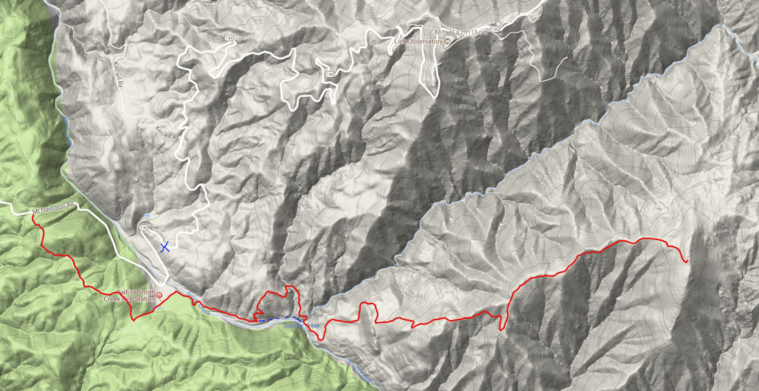
Once I made it to the fire station, I crossed Smith Creek and followed it east along the fence once I made it to the fire station, but I believe I might have missed when the trail to Mount Isabel got started. About a mile along the fence, I decided to just climb up the hill to the north and get a better view of what was coming. I was a bit surprised to see a large wild pig about 300 feet up the hill, who thankfully decided to cede the high ground and run away from me. Once at the top, I was able to catch the main trail ahead of me. I followed it and it eventually took me back down to the creek (d’oh!) and then to the climb up Mount Isabel. Along the way up, I saw another wild pig, a number of deer, and many groups of California quails.
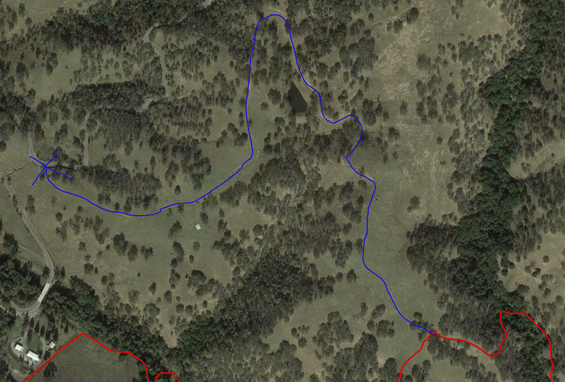
Part of the way up, the trail starts to follow a barbed wire fence with the summit in view down the line. At some point, the barbed wire is stretched apart to make it easy to pass to the other side to make the final approach along the ridge to the peak.


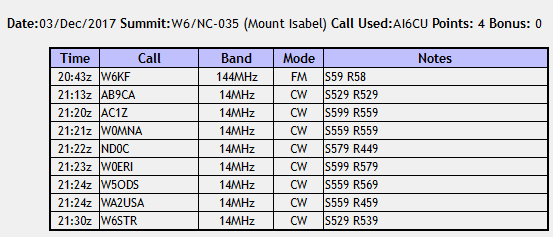
The summit had plenty of trees and bushes to hang wires up on, and there are some good views of the University of California’s Lick Observatory on Mt. Hamilton to the north. I chatted a bit with W6KF on 2m on my FT60 with a whip antenna (he was about 50 miles away) and then tossed a wire up into a dead tree for 20m CW on the KX2. AB9CA caught me early on and spotted me, so I soon had plenty of contacts.
On the way back, I followed the trail all the way to SR-130, where it met a bit down the road from the fire station, so I had to amble down a steep hillside to make it back. This would be another good starting point for the trail. All my detours ate up so much time that I didn’t have quite enough daylight to make it out to the nearby Copernicus Peak at the Lick Observatory (another SOTA peak and the tallest point in Santa Clara county), but I will return!
The one-way path took 5.14 miles and nearly 2500 feet of elevation to get to the 4230 foot peak. I’ve attached a GPS map of my course, along with a dotted blue line to denote the recommended path that sticks to the creek until the path crosses it. I’ve also used a blue X to mark the point where the trail meets SR-130 and would be a good place to park and follow a trail the entire way rather than following the creek.
Thanks to all the chasers for making this a successful outing (and to AA6XA for blazing the SOTA trail)!
 Tom Zajdel